Decision No. 03/2008/QD-BXD promulgating regulations on contents of drawings đã được thay thế bởi Circular 12/2016/TT-BXD proposals design regional urban special purpose zone constructon planning và được áp dụng kể từ ngày 15/08/2016.
Nội dung toàn văn Decision No. 03/2008/QD-BXD promulgating regulations on contents of drawings
MINISTRY OF CONSTRUCTION | SOCIALIST REPUBLIC OF VIET NAM |
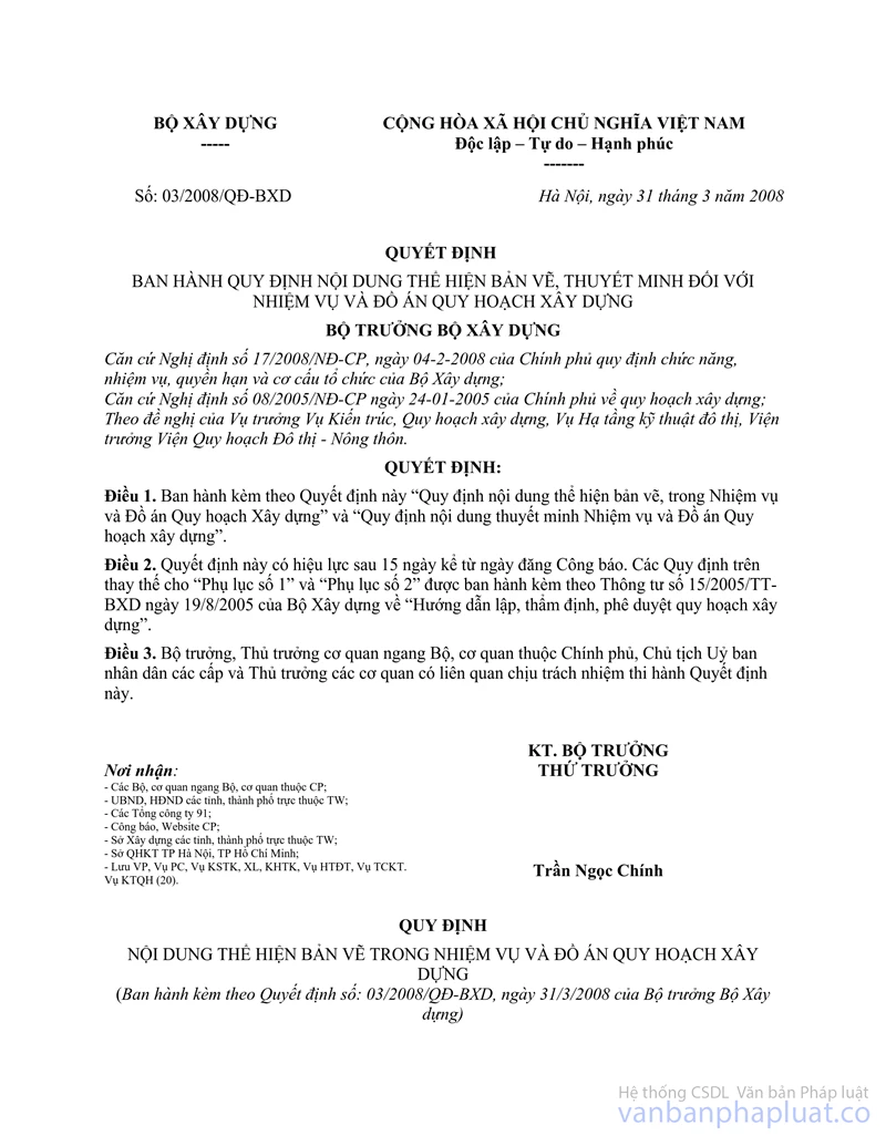
No. 03/2008/QD-BXD | Hanoi, March 31, 2008 |
DECISION
PROMULGATING REGULATIONS ON CONTENTS OF DRAWINGS AND EXPLANATORY STATEMENTS OF CONSTRUCTION MASTER PLANS AND TASKS
MINISTER OF CONSTRUCTION
Pursuant to Decree 17/2008/ND-CP dated 4 February 2008 of the Government providing for the functions, duties, powers and organizational structure of the Ministry of Construction;
Pursuant to Decree 08/2005/ND-CP dated 24 January 2005 of the Government on construction planning;
At the proposal of the Director of the Department of Architecture & Construction Planning, the Department of Urban Technical Infrastructure, the Director of the Rural – Urban Planning Institute.
DECIDES:
Article 1
To promulgate with this Decision the "Regulations on contents of drawings in Construction Master Plans and Tasks" and “Regulations on contents of explanatory statements of Construction Master Plans and Tasks".
Article 2
This Decision shall take effect 15 days from the date of publication in the Official Gazette. The above Regulations shall replace “Appendix 1” and “Appendix 2” issued with Circular No. 15/2005/TT-BXD dated 19 August 2005 of the Ministry of Construction on “Guidelines for preparation, evaluation, approval of construction planning".
Article 3
Ministers, heads of ministerial equivalent bodies, heads of governmental bodies, chairmen of people’s committees at all levels and heads of relevant bodies shall be responsible for the implementation of this Decision.
Recipients: | FOR MINISTER OF CONSTRUCTION |
REGULATIONS
ON CONTENTS OF DRAWINGS IN CONSTRUCTION MASTER PLANS AND TASKS
Issued with Decision No. 03/2008/QD-BXD dated 31 March 2008 of the Minister of Construction
A. CONTENTS OF DRAWINGS IN CONSTRUCTION PLANNING TASKS
I. For regional construction master plans
Pursuant to clause 2, article 6 of Decree 08/2005/ND-CP drawings of regional construction planning tasks are maps of regional locations, boundaries and relationships at 1/100,000 -1/500,000 scales. The contents of the drawings should include:
- Maps of the locations, boundaries and sizes of the studied regions and inter-regional geographical and natural relationships; urban residential areas; economic facilities, technical infrastructure affecting the planning regions;
II. For general master plans for urban construction
Pursuant to clause 2, article 14 of Decree 08/2005/ND-CP drawings of general planning tasks for urban construction are maps of locations, boundaries and regional relationships of 1/25,000 -1/100,000 scale. The contents of the drawings should include:
- Where there is an approved or agreed regional construction master plan, such regional construction planning map should serve as the basis for further clarification of the relationships which have direct impacts on the planning region and the planning municipality.
- Where there is no approved or agreed regional construction master plan, the reciprocal relationships between the municipality and the related region should be indicated in respect of the socio-economic aspect; focal technical infrastructure and other issues affecting urban development.
III. For detailed master plans for urban construction
Pursuant to clause 3, article 22 of Decree 08/2005/ND-CP drawings of detailed planning tasks for urban construction are maps of the location and boundaries of the designed region extracted from the general planning for urban construction or a smaller scale detailed planning at 1/5,000 - 1/10,000 scales. The contents of the drawings should include:
- The location, boundary and scope of the land detailed planning area;
- The relationships regarding functional zoning, planning space and technical infrastructure with neighbouring areas or the whole municipality;
- Eco-technical criteria relating to the land detailed planning area because the general master plan or detailed master plan is of a smaller scale than stipulated.
IV. For construction master plans for rural residential areas
Pursuant to clause 2, article 33 of Decree 08/2005/ND-CP drawings of construction planning tasks for rural residential areas are maps of the location and boundary of a commune at 1/25,000 scale; of the boundary of a commune centre or rural residential area at 1/5,000 scale.
In respect of special communes with a large natural area, the maps of location and boundary of a commune are at 1/50,000 scale.
B. COMPONENTS AND CONTENTS OF CONSTRUCTION PLANNING DRAWINGS
I. For regional construction master plans
Pursuant to clause 1, article 9 of Decree 08/2005/ND-CP of the Government on construction planning, drawings of regional construction master plans are specified as follows:
a. Components of drawings
1. Map of location and regional relationships at 1/100,000 – 1/500,000 scales;
2. Map of current status of population distribution and land use at 1/25,000 – 1/250,000 scales;
3. Map of current status of technical infrastructure system and environment at 1/25,000 -1/250,000 scales; (The contents of map 2 and map 3 can be integrated into one map);
4. Map of developmental direction for regional space at 1/25,000 - 1/250,000 scales;
5. Map of developmental direction for regional technical infrastructure system at 1/25,000 - 1/250,000 scales;
6. Map of strategic environment assessment at 1/25,000 – 1/250,000 scales.
b. General principles
1. With regard to regions which fall within the boundaries of one or more administrative units such as key regions, inter-provincial regions, large urban regions, provincial region, inter- district regions, district regions, the extent to which the contents are studied shall be indicated on the regional construction planning map. Depending on the subject, characteristics and size of each region, the included contents are stipulated in 3 types of map scales for the following types of regions:
- For inter-provincial regions, large urban regions (hereinafter referred to as inter- provincial regions), 1/100,000 1/250,000 map scales;
- For provincial regions, 1/50,000 1/100,000 map scales;
- For district regions, inter-district regions (hereinafter referred to as district regions), 1/25,000 ÷ 1/50,000 map scales;
2. With regard to regions formed on the basis of defined potentials and motives such as industries, ports, tourist areas, heritages, cultures, natural landscape, economic corridor, the extent to which the contents are studied shall be indicated on maps at the above stipulated 3 types of map scales.
3. The included contents depend on the subject and contents studied when the regional construction planning is prepared, whether it is for a multi-functional region or a specialised region such as a key region, inter-provincial region, provincial region, inter-district region, district region, industrial zone, large urban region, tourist [and/or] resort region, natural landscape or heritage conservation region... the planning maps must include the main contents appropriate to the requirements, objectives and development strategy of each type of region, clarify items of socio-technical infrastructure works which are of a scale and scope to allow region-wide service (accompanied by technical specifications);
4. The formatting rules of documentations (signs, lines, colours…) shall be in accordance with Decision 21/2005/QD-BXD dated 22 July 2005 of the Ministry of Construction.
c. Contents of regional construction planning drawings
1. Map of location and regional relationships
The contents of this map should include for all types of regions:
- Location, boundary of the region and inter-regional geographical and natural relationships; urban residential areas; economic facilities, technical infrastructure currently existing and planned to be developed which have impacts on the planning region;
2. Map of current status of population distribution and land use.
- With regard to inter-provincial regions and provincial regions, [this map] shall indicate the boundaries of district level administrative units in the region, the locations of municipalities of level V or higher; with regard to inter-district regions and district regions, [this map] shall indicate the boundaries of commune and higher level administrative units and the locations of commune centres, inter- commune and urban residential areas;
- Types of land relating to regional development: Tourist areas, cultural or historical relics, national security and defence, natural conservation, prohibited forests, national parks, water surface, forest parks, landscape areas, economic zones, mineral mines;
- Locations and sizes of industrial zones and industrial clusters, and scales of operation: With regard to inter-provincial regions, industrial zones, export- processing zones, national hi-tech zones shall be included; With regard to provincial regions, inter-district regions and district regions, provincial and district level industrial clusters shall also be included.
- Areas intended to be developed in the planning and projects which have been approved by the competent authority.
3. Map of current status of technical infrastructure system and environment. (the following contents can be included separately or integrated in one map)
- Technical infrastructure system
+ Locations of focal works such as railway stations, aerial ports, airports, sea ports, river ports, large region-level coach stations; Locations and classification of railway and road transport routes, included for all 3 types of regions. With regard to inter-provincial regions, provincial roads shall be included, with regard to provincial regions, district roads shall be included and with regard to district regions, commune roads shall be included;
+ Location and scale of power supply works comprising power sources, transformer stations, power distribution and transmission grids: With regard to inter-district regions and district regions, sources, stations and grids of the medium voltage of 22KV or higher shall be included, with regard to provincial regions, sources, stations and grids of 110KV or higher voltage shall be included and with regard to inter-provincial regions, sources, stations and grids of 220KV or higher voltage shall be included.
+ Systems of rivers, canals, lakes, scope of inundation, dykes, main irrigation works and network;
+ With regard to inter-provincial regions and provincial regions, locations and scales of focal works such as water sources, water plants, water supply stations, water supply systems and the regional water source protective belt shall be shown: With regards of inter-district regions and district regions, all water plants and works belonging to the district shall be included.
+ Locations and scales of solid waste treatment facilities, graveyards, waste water treatment stations at the regional level shall be included for 3 types of regions; with regard to inter-district regions and district regions, locations and capacities of urban and industrial waste water treatment stations shall also be included.
+ Technical infrastructure works, development planning and projects already approved.
- Current environment status
+ Pollution sources, polluted areas with degraded environment (in respect of soil, water, air, noise…). With regard to district regions, all polluted areas shall be included; with regard to provincial regions and inter-provincial regions, only areas with polluted water and air shall be included.
+ Regional ecosystems (special use forests, protective forests, natural reserves, wetland reserves…);
+ Areas prone to socio-economic and natural environment impacts;
4. Map of developmental direction for regional space
- Regional eco-technical facility distribution
+ Where a larger regional construction master plan is in place and the regional overall socio-economic direction has been approved by the competent authority, the contents shall mainly focus on elaborating the main socio- economic facilities which form the region (locations, scales…)
+ Where there is not yet such a plan, the map must clearly indicate industry developmental directions, relevant projects, data and documents in order to forecast the possibilities of distribution and development of production forces in the region, and to select construction sites appropriate to socio-economic development requirements.
- Distribution and organisation of residential area system:
+ Location, model of distribution and organization of the urban system and rural residential areas (in respect of district and inter-district regions), and commercial and service centres in the region, on the basis of size forecasts, classification and delegation of urban management;
+ Distribution and organisation of tourist and resort areas, exploitation and protection of natural landscape, and embellishment of historical and cultural relics.
5. Map of developmental direction for regional technical infrastructure system (the following contents may be included separately or integrated in one map)
- Technical preparation:
+ Identification and indication of areas in danger of natural and geological catastrophes (earthquakes, erosion, floods, land slides, collapses...);
+ Identification and indication of basins and main water surface drainage directions of the region;
+ Identification and indication of locations and technical specifications of large lakes, flood drainage works; flood control dykes.
- Transportation:
+ Classification, delegation and organization of road, railway, waterway and airway transportation networks of international, national, inter-provincial and intra-regional significances: All of these contents shall be included for all 3 types of regions. The minimum level of road transportation to be included shall be commune roads with regard to district; district roads with regard to provincial regions; and provincial roads with regard to inter-provincial regions.
+ Locations, natures and scales of focal transportation works and transportation servicing facilities such as railway stations, river ports, sea ports, aerial ports: included for all 3 types of regions. With regard to provincial and district regions, large coach stations and car parks and general transportation focal points shall be included.
- Water supply:
+ Locations and scopes of water sources (surface water and underground water).
+ Developmental direction for regional and inter-regional water supply (specifying zoning and areas supplied with water)
+ Location and scale of water supply works.
+ Main water transmission system of regional and inter-regional significance;
+ Identification of the scope of water supply environment protection.
- Power supply:
+ Identification and indication of locations and scales of power plants existing and planned to be constructed: included for all 3 types of regions.
+ Identification and indication of locations and scales of source transformer substations existing and planned to be constructed: included for all 3 types of regions.
+ Power transmission and distribution systems existing and planned to be constructed: Withregard to provincial and inter-provincial regions, transmission grids of 220KV and higher shall be included; with regard to district regions, transmission grids of 110KV and higher and distribution grids of 22 KV and higher shall be included.
- Dirty water drainage, solid waste management and graveyards:
+ Locations and scales of waste treatment facilities and auxiliary works: With regard to district regions, all these contents shall be included; with regard to provincial regions and inter-provincial regions, only treatment facilities and works for municipalities of type V or higher shall be included.
+ Locations and scales of graveyards: With regard to district regions, graveyards at inter-commune and higher levels shall be included; with regard to provincial regions, graveyards at district and higher levels shall be included; and with regard to inter-provincial regions, graveyards at provincial and higher levels shall be included.
6. Map of strategic environment assessment applied to all 3 types of regions and including:
- Source causing [environmental] impacts and areas prone to environmental impacts.
- Isolation and protective zones (special use forests, protective forests, heritage zones, water source basins, production isolation zone and other isolation and protective zones…)
II. For general master plans for urban construction
Pursuant to clause 1, article 17 of Decree 08/2005/ND-CP of the Government on construction planning, drawings of general master plans for urban construction are specified as follows:
a. Scales of drawings of general master plans for urban construction:
- In respect of special municipalities and type I municipalities: 1/25,000 1/10,000;
- In respect of type II and type III municipalities: 1/10,000;
- In respect of type IV municipalities: 1/10,000 1/5,000;
- In respect of type V municipalities: 1/5,000 1/2,000;
- In respect of districts of cities under central authorities, the scale for drawings to be applied shall be that used for those municipalities with the same population size.
b. Principles of inclusion
- Levels of study and inclusion of specialized subjects in a general master plan for urban construction on topographic base maps at the following scales:
+ In respect of study plan at 1/25,000 scale: to urban main roads;
+ In respect of study plan at 1/10,000 scale: to inter-area roads;
+ In respect of study plan at 1/5,000 scale: to area roads;
+ In respect of study plan at 1/2,000 scale: to area dividing roads.
- Depending on the contents and requirements identified in the planning task of each municipality type approved by the competent authority, planning maps of total land use area according to planning phases and planning maps of technical infrastructure work system may be included in the same map or separated for each planning phase, but the main eco-technical specifications relating to planning phases must be included.
- Technical infrastructure focal works located outside a municipality shall be included in a chart indicating connections with such municipality;
- The map must include all necessary eco-technical data required by the study contents of each specialized subject;
- The formatting rules of documentations (signs, lines, colours…) shall be in accordance with Decision 21/2005/QD-BXD dated 22 July 2005 of the Ministry of Construction.
c. Components and Contents of Drawings
The components and contents of drawings of general master plans for urban construction shall be indicated on the base map at the scales provided in paragraph a.
1. Map of location and regional relationships (Scales 1/50,000 – 1/250,000);
- Where there is no approved or agreed regional construction planning map, the reciprocal relationships between the municipalities and the related zone should be included with regard to:
+ Socio-economic aspects;
+ Topographic and terrain conditions, areas which have large impacts on urban landscape and architecture;
+ Focal technical infrastructure and other issues affecting urban development.
- Where there is an approved or agreed regional construction planning map, on the basis of such regional construction planning map, further clarification of only the relationships which have direct impacts on the planning region and the planning municipality as stipulated above shall be required.
2. Map of overall status and construction land selection (the following contents may be included separately or integrated in the same map).
- Map of urban formation and development history: Maps, charts and illustrative images of the historical structure of the municipality and changes in its functions and form, if any.
- Current land use status:
+ Administrative boundaries of wards and communes of the existing municipality and areas planned to be expanded;
+ Current land use status by functional zones such as: Land for housing units; urban public works; administrative offices; mixed central areas; national security and defence, beauty spots and famous landscape; industrial zones, industrial centres, warehouses, stations and grounds; unused land; agricultural land…;
+ Current land use status for technical infrastructure works such as: Land for construction of external transportation and urban transportation networks, land for construction of focal road, railway, waterway and airway works, water plants, power plants, power distribution stations, irrigation lakes, waste water treatment stations, graveyards, solid waste landfills ...
+ Current status of land areas used for underground space exploitation according to urban functional zones.
- Current landscape and architecture status: Assessment, analysis, identification and clear indication of locations and boundaries of landscape and architecture areas, typical areas…. which form the image (special feature) of the municipality.
- Current transportation status: External transportation and intra-urban transportation networks and focal road, railway, waterway and airway works (identifying locations, scales, grades and whether they are above or under-ground …)
- Current status of power supply and urban lighting: Power supply network of medium or higher voltage: Power sources (power plants, source transformer stations), power supply and distribution grids above and under-ground. In respect of type IV and type V municipalities, grid stations shall also be included. Urban public lighting (current status of lighting for transportation works, public works …)
- Current water supply status: Water supply sources, locations, scales, water treatment plants, pumping stations, water regulation stations and water supply and transmission pipeline networks;
- Current status of technical preparation: Current status of ground levelling, surface water drainage, main water drainage basins, flooded areas, detention reservoirs, canal routes, sewerage system for rain water drainage and irrigation works, current altitude at road intersections;
- Current status of dirty water drainage and environment hygiene: Waste water drainage network, locations and scales of the following works: pumping stations, waste water treatment stations, waste treatment facilities and auxiliary works, locations and scales of graveyards and funeral parlours.
- Current environment status: Pollution-causing sources in the municipality; polluted areas and levels of pollution and environment degradation; sensitive areas in the municipality (sensitive ecosystems, heritage conservation zones, landscape preservation zones …)
- General assessment and selection of construction land:
+ Identification and clear indication of areas where construction is not permitted (such as cultural or historical relics; natural conservation zones; military zones), areas where construction is prohibited or restricted, and other natural or artificial obstructions;
+ Classification of land funds according to the degree of favourableness for construction and development (with regard to natural conditions, technical infrastructure supply conditions and other related conditions).
3. Analysis charts and urban development structure chart (minimum 2 alternatives, including the selected option)
4. Map of land use planning and functional zoning according to planning phases;
- Administrative boundaries of existing districts, wards and communes and boundaries of city areas and housing units as planned;
- Administrative boundaries of urban districts and wards and suburban district and communes as existing and planned to be adjusted.
- Land use by functions such as: Housing units; service zones; greenery and park areas; industrial zones, industrial centres, warehouses, stations and grounds; administrative office areas, professional training schools, research institutes… and other special functional zones;
- Urban functional zones, making a clear distinction among existing areas to be retained or re-developed; newly built in the first phase and in the long term (urban expansion land for the planning term of 20 years), land reserved for development.
- Areas planned for urban underground space use;
- Main eco-technical specifications of each functional zone: Area; population; maximum and minimum construction density. With regard to urban main space areas, the maximum and minimum number of constructed floors should be stipulated;
5. Map of developmental direction for urban space;
- Clear identification of main direction for space development; structuring urban space development according to functional zones; emphasis on public spaces, main urban axes, open spaces, squares, parks, water surfaces … Transportation and technical infrastructure connections between areas.
- Identification and indication of boundaries of areas where development requires intervention and control such as: Conservation, improvement, upgrade and embellishment areas, newly developed areas, and other urban landscape and architecture areas which require protection.
- System of urban central areas
- Areas where construction of underground works is planned;
6. Maps of developmental direction for technical infrastructure system and environment protection.
(The contents of the following maps can be integrated, but each map shall include no more than 3 subjects).
- Map of technical preparation direction:
Basins and water drainage directions;
+ Systems of rivers, canals, reservoirs, dykes, embankments …;
+ Rain water drainage systems;
+ Identification and indication of construction altitude for the municipality, each area and urban main road axes; earthwork areas.
- Map of developmental direction for transportation;
Transportation planning
+ Networks and external transportation works of roads, railway, riverway, seaway, airway (railway routes and stations, river ports, sea ports, aerial ports, inter-provincial coach stations...);
+ Intra-urban transportation network; locations and scales of works above or under-ground (classification of streets, bus stations, car parks, automobile tunnels, pedestrian tunnels, underground stations, waterway routes, boat wharves. Locations of complex transportation focal points);
+ Map of public transportation route organisation (in respect of municipalities of special types, type I, type II and type III) consisting of: Urban railway and bus routes (above or under-ground).
+ Details of cross sections of urban main road types.
Red-line boundary planning of main transportation routes;
+ Identification of coordinates of design marks according to road centrelines at intersections of urban main road routes planned for new construction based on the coordinate grid of the survey map used for planning formation;
+ Identification of red-line boundaries of main road routes at the municipal level.
- Map of water supply direction;
+ Water supply sources: Underground water, surface water (max-min surface water flows, underground exploitation level…;
+ Water supply zoning;
+ Locations and scales of water treatment and collection works, regulation and supercharging works;
+ System of main transmission pipelines at level 2 or higher; crude water conveyance routes;
+ Chart of hydraulic calculations for the water supply pipeline network;
+ Identification of the protection scope of water sources and water supply works.
- Map of power supply direction;
+ Locations and voltage capacity of power sources;
+ Power supply and distribution networks of medium or higher voltage. In respect of type IV and type V municipalities, grid stations shall also be included.
+ Lighting networks on main road routes at the municipal level, public works at the city level;
- Map of direction for dirty water drainage, solid waste management and graveyards:
+ Waste water receipt sources, main water drainage canals of the municipality;
+ Allocation of water drainage basins;
+ Water drainage systems at level 2 or higher; locations and scales of pumping stations and waste water treatment stations, large detention reservoirs;
+ Locations and scales of waste treatment facilities and auxiliary works, solid waste transit stations;
+ Locations, scales and boundaries of graveyards and funeral parlours.
- Map of strategic environment assessment
+ Pollution causing sources in the municipality, areas in danger of pollution and degraded environment.
+ Isolation and protective areas (parks, heritage zone, water source basins, production isolation zones...) and other environment sensitive zones.
7. General map of technical pipelines and lines
On the basis of technical infrastructure planning maps, the general map of technical pipelines and lines should indicate:
- Arrangement, layout, locations of technical tunnel and trench routes, lines, pipelines and technical infrastructure focal works on site, especially on the main roads planned for new construction;
- Identification of dimensions and distances between routes with other works within red-line boundaries on road cross section at 1/100 ÷ 1/200 scale;
- At complex intersections, a chart shall be required to identify the depth and vertical distance between technical pipelines and line routes.
III. For detailed master plans for urban construction
Pursuant to clause 1, article 26 of Decree 08/2005/ND-CP of the Government on construction planning, drawings of detailed master plans for urban construction are specified as follows:
a. Principles of inclusion
- Subject to the specific requirements of each plan, the contents of the technical infrastructure and environment subjects can be integrated in one map, but the map must include all the contents of each specialized subject;
- The map of technical infrastructure work system should include a chart indicating connections with technical infrastructure focal works located outside the detailed planning land area.
- The map must clearly include all necessary eco-technical data appropriate to each type of detailed master plan;
- Subject to each type of master plan, the map can be of a reduced scale but such map must be ensured to be reduced from original survey maps of 1/2,000 and 1/500 scales;
- The formatting rules of documentations (signs, lines, colours…) shall be in accordance with Decision 21/2005/QD-BXD dated 22 July 2005 of the Ministry of Construction.
b. Components and contents of detailed construction planning drawings of 1/2,000 scale
1. Map of location and limits of the land area of 1/10,000-1/25,000 scales;
The map of location and boundary of the designed land area is extracted from the general urban construction planning map or a smaller scale detailed land use master plan. The contents of the map should clearly indicate:
- The location, boundary and scope of the detailed planning land area;
- Relationships regarding functional zoning, planning space and technical infrastructure with neighbouring areas or the whole municipality;
- Identification of areas which have impacts on the landscape and architecture of the detailed planning area
- Eco-technical targets relating to the detailed planning land area because the general master plan, regional master plan or detailed master plan is of a smaller scale than stipulated.
2. Map of current status of landscape and architecture and assessment of construction land;
a. Clear indication of scopes, boundaries and functions of use (land for residential housing groups, urban service works, mixed use areas, gardens, parks, industrial use, underground works…) External transportation focal points and area of each street grid (limited by area dividing lines). If a street grid has different functions of use, each type of function must be clearly indicated;
b. Analysis and identification of characteristics of the area
- Land use characteristics according to separate function or mixed use;
- Architectural space and form of each area
- Architectural works of cultural and historical values
- Important public spaces in the area
- Areas of beautiful views and vision-attracting points
- Natural landscape factors (hills, mountains, greenery, water surface ...)
- Construction works using underground space.
3. Maps of current status of technical infrastructure system and environment protection;
- Transportation:
+ Urban transportation networks above and under-ground: Roads, railway, waterway, airway transportation, urban railway and street routes according to their type and width;
+ Locations and scales of coach stations, railway stations, river ports, sea ports, aerial ports, airports ...;
+ Locations and scales of transportation servicing facilities above and under- ground: Car parks, squares, intersections, pedestrian overpasses; pedestrian tunnels ...
- Water supply:
+ Items to be included are networks, altitude of water supply pipelines and works on pipelines such as valve holes, fire hydrants ...;
+ Locations, scales and capacities of existing water supply works and sources;
- Technical preparation:
+ Ground altitude at road intersections and special points.
+ Areas regularly flooded.
+ Existing dykes and embankments;
+ Existing rain water drainage systems and sewerage network;
+ Focal works: Irrigation pumping stations, urban drainage pumping stations.
- Waste water drainage, solid waste management and graveyards:
+ Waste water drainage network;
+ Locations and scales of pumping stations, waste water treatment stations, solid waste assembly point and treatment zone, graveyards and funeral parlours.
- Urban lighting and power supply:
+ Power sources;
+ Medium and high voltage grids and transformer stations;
+ Low voltage grids and urban lighting.
- Current environment status;
+ Pollution causing sources in the area
+ Polluted areas and levels of pollution and environment degradation.
+ Sensitive ecosystems (parks, spaces with greenery, water surface …).
+ Ecology and natural conservation (terrestrial and aquatic animals, flora and fauna to be preserved)
4. Map of total land use area planning;
- The functions of land use of each street grid (defined by area dividing lines) shall be indicated, comprising: Land for residential housing groups, urban service works, mixed use areas, gardens, parks, industrial use, areas planned to be constructed and to use underground spaces… If a street grid has different functions of use, each type of function must be clearly indicated;
- Existing areas, improved areas and newly developed areas shall be clearly distinguished;
- Eco-technical specifications: Land area, population, works scale, construction density, land use co-efficient and maximum and minimum number of floors for each functional zone;
5. Map of landscape and architectural space organization
- Space organization should identify and clearly indicate the manner of organization
of route directions, landscape axes and landmark works in the area, open space systems (squares, parks, greenery, water surfaces, decoration of pavements and arrangement of infrastructure utility works and form of space development by lot and by route).
- Space organization for typical landscape areas and identification of areas which require intervention and have impacts on architecture and landscape
- Stipulated maximum and minimum heights in each land lot, street grid and street route in the area
6. Illustrative drawings
- Plan and elevation drawings for implementation according to typical street routes and street lots, solutions for new design or reform of architectural space and improvement of urban landscape must be clearly indicated.
- Perspective illustrative drawings of typical areas, open spaces, typical works and clusters of works in the studied area.
- Drawings guiding design of public works and clusters of public works using underground spaces, works situated at street corners, interposed works, preservation works ...
7. Map of transportation planning and red-lined boundaries and construction boundaries.
- Transportation:
+ The transportation network should clearly indicate the site of external transportation routes (roads, railway, waterway, airway), urban railway routes (above or under-ground) and types of streets up to area dividing lines;
+ Identification of locations and scales of transportation works above or under- ground: Car parks and bus stations, railway stations, ports, boat wharves, aerial ports, intersections, bridges, sewerages, squares and other transportation servicing facilities;
- Red-lined boundaries and construction boundaries
+ Red-lined boundaries and corridors protecting technical infrastructure routes shall be indicated; design coordinates shall be identified at positions with changes in direction and at intersections;
+ Street plan drawings which identify dimensions, red-lined boundaries and construction boundaries.
8. Maps of technical infrastructure system and environment planning
- Technical preparation:
+ Identification of construction altitude at road intersections, angle of slope on roads, and identification of construction ground altitude;
+ Height planning design;
+ Identification of boundaries, volumes and areas of earthwork;
+ Inclusion of the rain water drainage system (network, altitude of the entire system, draw-offs, locations, capacities and areas of land occupied by pumping stations and detention reservoirs)
+ Other technical preparation works: Dykes, embankments.
- Water supply:
+ Identification of water supply sources and locations of water supply points for the area;
+ Water supply pipelines identified in the construction general master plan; the main pipeline route of the area;
+ Network and altitude of main pipelines and branch pipelines to works or land lots), works on pipelines such as public taps, valve holes, fire hydrants …;
+ Locations and scales of any tanks, pumping stations or water towers within the designed land lot must be fully included.
- Waste water drainage, solid waste management and graveyards:
+ Locations and receipt points of surface water and waste water of the area;
+ Design of the main waste water drainage network: Canals, ditches, box culverts ... at level 2 or higher (with culvert bed altitude at calculation points);
+ Locations, areas of land occupied by and capacities of pumping stations, waste water treatment stations, collection points, transit points and treatment stations for solid wastes, graveyards, funeral parlours.
- Urban public lighting and power supply:
+ The power supply network shall be fully included, comprising: Power sources, medium and high voltage grids, transformer stations, low voltage grids, lighting grids for transportation works and public works.
- Environment impact assessment:
+ Pollution causing sources in the area and areas in danger of pollution and environment degradation.
+ Isolation and protective areas (parks, heritage zones, water sources, production isolation zones …) and other sensitive environment areas.
9. General map of technical pipelines and lines;
- This map is prepared on the basis of technical infrastructure planning maps and includes:
+ Site of trench routes, tunnels, lines, pipelines and technical infrastructure focal works;
+ Road route cross section (at 1/100 or 1/200 scale) which includes identification of locations and sizes of trench routes, tunnels, technical lines & pipelines within red-line boundaries and horizontal distances between routes;
+ At road intersections where there is a complexity of traversing technical routes, the solution of arrangement or layout of such technical routes on site should be shown in the form of a chart with specified relevant technical specifications to identify the depths and vertical distances between technical pipelines and line routes.
c. In respect of construction detailed master plans at 1/500 scale
- Map of location and boundary of the designed land area: Extracted from the construction general planning map at 1/5,000 – 1/10,000 scale, or detailed land use master plan at 1/2,000 scale. The contents should clearly indicate:
- The location, boundary and scope of the detailed planning land area;
- Relationships regarding functional zoning, planning space and technical infrastructure with neighbouring areas or the whole municipality;
- Identification of areas which have impacts on the landscape and architecture of the detailed planning area.
- Eco-technical criteria relating to the detailed planning land area because the general master plan or detailed master plan is of a smaller scale than stipulated.
In addition to the requirements with regard to construction detailed master plans at 1/2000 scale, the contents of maps in detailed master plans for urban construction at 1/500 or larger scale should also include the following detailed contents on the integrated topographic and cadastral map at 1/500 or larger scale:
- Map of current landscape and architecture status: Assessment of the quality of works (by 3 types of permanent, semi-permanent and temporary), identification of number of floors, basement, construction density, and valuable works which should be retained, preserved and embellished. Assessment of the value of landscape, greenery, water surface and other environment factors; drawing, recording or using photos or documentaries to illustrate the current architecture status and social utilities facilities;
- Map of total land use area planning: The function of each land lot shall be clearly identified, such as: Residential land (defined by fences of land lots for villa construction and adjoining houses – not including playground, internal roads and common car parks of groups of residential houses, or defined by the areas of land occupied by apartment blocks); service facilities; greenery, parks, gardens, internal playgrounds of groups of residential houses; administrative offices, professional training schools; industrial [zones], industrial centres … Existing areas, improved areas and newly developed areas shall be clearly distinguished; The eco-technical criteria for each land lot shall be clearly indicated, for example: population size, work scale, construction density, maximum and minimum numbers of floors, basement.
- Map of landscape and architectural space organization planning: Layout of landscape and architectural space; Arrangement of architectural works and technical infrastructures, yards and gardens, greenery in parks and streets, pedestrian roads, footpaths and other urban utility works.
Identification of the work or group of works with the most number of floors in the planning area.
Maps to illustrate ideas of landscape and architectural space organization
- Maps of technical infrastructure work system planning:
+ Transportation: Road networks showing details to each work; internal car parks, yards and roads; proposed solution for structures of roads for automobiles and for pedestrians, and transportation servicing facilities above and under-ground;
+ Technical preparation: Collection wells; septic tanks; bents, barrier walls shall be included; depending on the topographic conditions, the design contour line and volume calculation drawings must be included;
+ Water supply: Main pipelines and branch pipelines to the constructed land lot (excluding the works) shall be included.
+ Waste water drainage and environmental hygiene: Identification of the locations of waste water drainage routes at level 3 or higher, septic wells (including sewer bed altitude); identification of solid waste collection points and public toilets.
+ Electricity supply: Indication of locations of transformer stations, main power lines, power lines to public works and the distance between power poles, protective corridor of the high voltage power grid and street lighting.
IV. For construction master plans for rural residential areas
Pursuant to clause 2, article 34 of Decree 08/2005/ND-CP of the Government on construction planning, drawings of construction master plans for rural residential areas are specified as follows:
a. Components of Drawings:
1. General map of current status and assessment of construction land at 1/5,000-1/25,000 scales;
2. Map of developmental direction for the rural residential area network, technical infrastructure system and environment at 1/5,000 - 1/25,000 scales;
3. Map of overall planning of architectural space and technical infrastructure of commune centres and rural residential areas at 1/500 - 1/2,000 scales;
b. General principles
- Depending on the complexity of each master plan, the planning contents may be included in several separate drawings or in one drawing;
- Technical infrastructure focal works located outside the construction planning scope shall be included in a chart indicating connections with the construction planning area.
- Drawings should clearly include all eco-technical data related to each functional zone or item of work;
- The formatting rules of documentations (signs, lines, colours…) shall be in accordance with Decision 21/2005/QD-BXD dated 22 July 2005 of the Ministry of Construction.
c. Contents of drawings in construction master plans for rural residential areas
1. General map of current status and assessment of construction land:
The following contents shall be included in the topographic base map combined with the cadastral map:
- Administrative boundaries of communes;
- Types of land: Land for agricultural, forestry and aquatic production; land for industry, small industries and handicrafts, servicing productions (stations, barns, warehouses ...); land of central areas, residential areas and other types of land (defence, tourist areas, unused, rivers, streams ...);
- Population, number of households, area of each residential area;
- System of support facilities for services and production activities in the commune;
- Technical infrastructure system:
+ Routes of national roads, provincial roads, district roads, commune roads, hamlet roads. Types and sections of roads shall be clearly indicated;
+ Irrigation works and system: Clear indication of grades, types, sections and main eco-technical criteria; indication of main water drainage basins;
+ In respect of centralized water supply, sources and works of water supply as well as the system of main and branch pipelines to each residential area should be included. In respect of decentralized water supply, the type of water supply by area should be indicated;
+ Lakes, ponds, system of canals, water drainage pipelines to each residential area, graveyard areas, solid waste landfills;
+ Power supply, low voltage stations and distribution grids of medium or higher voltage. Station capacity, voltage and type of cables shall be clearly indicated.
- Capacity of the construction land fund and expansion directions for each residential area and commune central area.
- Environment:
+ Pollution causing sources in the area and areas with pollution and degraded environment.
+ Sensitive ecosystems (forests, greenery, water surface …).
2. Map of developmental direction for the rural residential area network and technical infrastructure system within the commune.
The following contents shall be included in the topographic base map:
- Currently available construction land, expanded construction [land] for each residential area and commune central area, and land reserved for development;
- Land use characteristics by functions: Agricultural, forestry and aquatic production; industries, small industries and handicrafts; residential land, land for services (office, education, medical, commercial ... purposes); land for focal technical infrastructure works;
- Residential areas to be developed, to be restricted from developing and not to be developed;
- Population, number of households, area of each residential area;
- System of support facilities for services and production activities in the commune;
- Technical infrastructure system:
+ Direction and main basins for water drainage; identification of construction altitude for residential areas;
+ Road network in the commune (national roads, provincial roads, district roads, commune roads, hamlet roads); road types and sections; transportation servicing facilities;
+ In respect of centralized water supply: Water supply sources; locations of water collection and conveyance works, treatment and regulation works; water transmission pipeline network and water supply works; pipeline network hydraulic calculation charts; identification of the protective belt for water sources and water supply works;
+ In respect of decentralized water supply: Water supply sources; water treatment and supply works.
+ Power supply sources; Locations, capacities and voltages of low voltage stations; distribution grids of low and medium voltages; protective corridor for traversing high voltage power lines;
+ Waste water drainage and treatment systems; locations and scales of solid waste treatment areas, graveyards;
3. Map of overall planning of architectural space and technical infrastructure of commune centres and rural residential areas
The following contents shall be included in the topographic base map combined with the cadastral map:
- Architectural works such as residential houses, public works ... and greenery;
- Boundary of each land lot by characteristics and functions of use, with clear distinction of existing areas, improved areas and newly developed areas;
- Land use requirements: Land area, construction density, number of floors, construction boundary and ratio of greenery for each land lot;
- Technical infrastructure network:
+ Sites of types of roads to each construction land lot and sufficient inclusion of technical specifications;
+ Identification of earthwork areas, construction altitude, angle of slope on roads and construction ground, direction of water drainage, canals, pipelines for water drainage, dykes, embankments and lakes which are planned.
+ In respect of decentralized water supply: Water supply sources; water treatment and storage works;
+ In respect of centralized water supply: Water supply sources and works; water supply pipeline network to each land lot;
+ Networks of pipelines, pumping stations, waste water treatment stations, solid waste collection and treatment systems;
+ Power sources: Power supply network 0.4 KV or higher and street lighting; locations of works such as transformer stations, distances between power poles...
- Environment impact assessment:
+ Pollution causing sources in the area and areas in danger of pollution and degraded environment.
+ Isolation and protective areas (forests, heritage zones, water sources, production isolation zones...) and other environment sensitive areas.
V. For construction planning adjustment master plans
The requirements for construction planning adjustment are provided in articles 12, 20, 29 and 37 of Decree 08/2005/ND-CP and guidelines are provided for certain contents as follows:
1. Adjustment tasks:
- Studying and assessing the process of urban development investment according to the approved construction planning. Based on the actual socio-economic development and factors affecting the urban development process, identifying problems which must be periodically adjusted;
- Partially adjusting the construction planning due to the appearance of factors which change one or several of the characteristics, functions, scales, eco-technical criteria ... of one or more areas already identified in the previous construction planning without changing the major developmental directions of socio-economy, architectural space layout, and arrangement of the main technical infrastructure network already identified in the previous construction planning.
2. Components and contents of construction planning adjustment drawings:
a. Contents of adjustment
- Emphasis shall be placed on clear indication of which contents to be adjusted, what additions or amendments are proposed and how to amend, including:
+ Regarding land use, urban space, landscape and architecture
+ Regarding the technical infrastructure system;
+ Regarding urban development criteria.
b. Components of adjustment drawings
- Drawings shall clearly indicate the contents requiring adjustment in connection with the contents not requiring adjustment, ensuring continuity with the previously approved construction planning master plans;
- The components of drawings shall be specified in the construction planning adjustment task based on actual requirements of construction planning adjustment master plans.
REGULATIONS
ON CONTENTS OF EXPLANATORY STATEMENTS OF CONSTRUCTION MASTER PLANS AND TASKS
Issued with Decision 03/2008/QD-BXD dated 31 March 2008 of the Minister of Construction
A. CONTENTS OF EXPLANATORY STATEMENTS OF CONSTRUCTION PLANNING TASKS
I. For regional construction master plans
The contents of regional construction planning should clearly identify the scope, objectives, requirements for study and product documentation of the master plan.
Depending on the subject and contents studied, regional construction planning shall be formulated with multi functions or specialised functions such as a key region, inter-provincial region, provincial region, inter-district region, district region, industrial region, large urban region, tourism [and/or] resort region, natural landscape or heritage conservation region…, such that the jobs and products to be achieved shall be clarified in the master plan according to the following main contents:
1. Reasons and necessity for planning formation
- Stating reasons for planning: The scope and requirements for planning may be set for a specific region or specialised region, depending on the requirements of socio-economic development strategies and population distribution of the nation, of an eco-geographic area... for regional planning with multi functions by administrative territories (province or district); or on forecasts for industrial development or development of a specific economic area and other factors.
- Identification of planning type: Planning for comprehensive regions (planning for provincial regions or district regions) or for specialised regions (industrial region, tourist areas, special economic zones …).
- General information on the location and position of the planning area in inter-regional relationships which may have impact on the studied region.
- Identification of the key objectives of the preparation of a master plan for the studied region.
2. Grounds for planning
The main grounds for planning shall be stated, including:
- Legal grounds (written directions of the Government, the province or industry …);
- Data and documentary sources (compiled statistics, specialised planning documents …);
- Grounds being maps (types of maps and scales).
3. Requirements for contents of the planning study
The contents of the planning study shall be identified according to the main sections of:
a. General assessment of the current status and development resources of the studied region:
- Limiting the scope of planning, scopes of study; identification of the location and scope of the planning area on the drawing Map of planning location and scope (A3 drawing) accompanied by the tasks.
- Brief description of the current status of the planning region.
- Brief description of the related development forecasts.
b. Requirements of bases for forecast of the regional development scale
Identification of the list of contents requiring collection of materials and survey to assess the current status of the planning area (such as natural conditions; current socio-economic status; current status with regard to population, urban areas, social and technical infrastructure…). The list of contents requiring collection of related specialised planning materials.
c. Requirements for contents to be studied in the regional construction planning
Appropriate requirements for contents shall be proposed depending on the type of planning region, especially with regard to specialised region planning; the works to be implemented in order to fulfil the tasks to be studied in the regional master plan shall be clarified as follows:
- Identification of the vision and objectives for regional development.
- Forecasts for regional development.
- Proposal for development zoning.
- Developmental direction for regional space.
- Developmental direction for regional technical infrastructure system (large scale)
- Strategic environment assessment.
- Investment programs for regional development.
4. Product documentation and estimated budget
a. Requirements for product documentation
- Components and contents of documentation drawings (name of drawings and scales of drawings)
- Explanatory statements and attached documents.
b. Estimated budget
- The estimated budget shall be prepared according to the planning contents.
5. Organization of implementation
- Proposal on the timing and schedule of the implementing steps of study, reporting and evaluation.
- Planning preparing bodies, evaluation body, planning task approval authority and planning approval authority.
II. Contents of general planning tasks for urban construction
The contents of general planning tasks for urban construction should clearly identify: Objectives; philosophy on urban development; research boundary and scope of construction general planning formation, requirements for study and the product documentation of the master plan.
Depending on each master plan, the works and products to be implemented in the master plan should be clarified according to the following main contents:
1. Reasons and necessity for planning
- Stating reasons for planning: The scope and requirements for planning preparation (adjustment) may be set according to the requirements of socio-economic development strategies and population distribution of the nation, of an eco- geographic area, of a province or sub-region in a province...; according to forecasts for industrial development or eco-technical development, to urban management requirements, requirements for completion and improvement of the quality and aesthetics of urban landscape and architecture, and other factors.
- General information on the location and position of the municipality in inter-regional relationships which may have impact on the studied municipality.
- General information on urban development potentials and motives.
- Identification of objectives of the preparation of a general master plan for urban construction.
- Identification of the philosophy for urban construction planning.
2. Grounds for planning
The main grounds for planning preparation shall be stated, including:
- Legal grounds (written directions of the Government, the province or industry …);
- Data and documentary sources (compiled statistics, specialised planning documents …);
- Grounds being maps (types of maps and scales).
3. Requirements for contents of the planning study
Studied boundary and scope of study (which may be broader than the boundary of the existing municipality);
- Preliminary forecast of the population size and size of land for urban construction.
The official size of the municipality is the size proposed in the study plan and approved by the competent authority;
- Stating the requirements for study in the general master plan to achieve the master plan contents provided in article 16 of Decree 08/2005/ND-CP on construction planning.
4. Product documentation and estimated budget
a. Requirements for product documentation:
Pursuant to article 17 of Decree 08/2005/ND-CP on construction planning and the specific requirements of each master plan, the list of master plan documentation required shall be specified:
- Contents of drawings (name of maps and scales of maps)
- Contents of explanatory statements and attached documents.
b. Estimated budget:
- The estimated budget shall be prepared according to the planning contents.
5. Organization of implementation
- Proposal on the timing and schedule of the implementing steps of study, reporting and evaluation.
- Planning preparing bodies, evaluation body, planning task approval authority and planning approval authority.
III. Contents of detailed planning tasks for urban construction
The requirements for contents of detailed planning tasks for urban construction are as follows:
- In respect of detailed planning for urban construction at 1/2,000 scale, the following should be specified: - Objectives; urban development requirements for land use, landscape – architecture – environment; requirements for connection of the technical infrastructure system with adjacent areas in conformity with the approved construction general planning and the requirements on contents of detailed master plans provided in article 24 of Decree 08/2005/ND-CP on construction planning.
- In respect of detailed planning for urban construction at 1/500 scale, the following should be specified: - Objectives; construction investment requirements; requirements for land use, landscape – architecture – environment; requirements for connection of the technical infrastructure system with adjacent areas in conformity with the approved construction general planning and detailed planning at 1/2,000 scale; and the requirements for contents of detailed master plans provided in article 24 of Decree 08/2005/ND-CP on construction planning.
Depending on each master plan, the works and products to be implemented in the master plan should be clarified according to the following main contents:
1. Reasons and necessity for planning
- Reasons and necessity for detailed planning;
- Objectives of and requirements for urban development in respect of the planning area.
2. Grounds for planning
- Legal grounds;
- Data and documentary sources
- Grounds being maps.
3. Requirements for contents of the planning study
- Boundary and scope of study;
- Main characteristics of the studied area;
- Depending on the characteristics of each master plan, preliminary forecast of the population size, or size of the planned functional zones;
- Stating the requirements for study in the detailed master plan to achieve the master plan contents provided in article 24 of Decree 08/2005/ND-CP on construction planning.
4. Product documentation and estimated budget
a. Requirements for product documentation:
Pursuant to article 24 of Decree 08/2005/ND-CP on construction planning and the specific requirements of each master plan, the list of master plan documentation required shall be specified:
- Components and contents of drawings (name of drawings and scales of drawings);
- Explanatory statements and attached documents.
b. Estimated budget:
- The estimated budget shall be prepared according to the planning contents.
5. Organization of implementation
- Proposal on the timing and schedule of the implementing steps of study, reporting and evaluation.
- Planning preparing bodies, evaluation body, planning task approval authority and planning approval authority.
IV. Contents of construction planning tasks for rural residential areas
Depending on the characteristics of each commune or residential area, a planning task should specify the requirements for study contents and products to be implemented according to the following main contents:
1. Reasons and necessity for planning
- Stating reasons for planning formation: The scope and requirements for planning preparation (adjustment) may be set according to the requirements for socio- economic development of the commune or district; requirements for construction management, land management of the central area of the commune or residential area; requirements for infrastructure system development in the commune, the central area of the commune or residential area, and other factors.
- General information on the location of the commune or residential area in mutual relationships of the inter-commune region or the commune which may have impact on the studied area.
- General identification of development potentials and motives in the commune or inter-commune region.
2. Grounds for planning
The main grounds for planning shall be stated, including:
- Legal grounds (written directions of the district, province or industry …);
- Data and documentary sources (compiled statistics, specialised planning documents …);
- Grounds being maps (types of maps and scales).
3. Requirements for contents of the planning study
- Studied boundaries including boundary of the entire commune; boundary of the centre of the commune or residential area.
- Preliminary forecasts of population size and construction land size;
- Specifying the requirements for construction planning master plan for rural residential areas, the centre of commune or residential area under study in order to achieve the content of the master plan pursuant to article 34 of Decree 08/2005/ND-CP on construction planning.
4. Product documentation and estimated budget
a. Requirements for product documentation:
Pursuant to article 34 of Decree 08/2005/ND-CP on construction planning and the specific requirements of each master plan, the list of master plan documentation required shall be specified:
- Contents of drawings (name of maps and scales of maps)
- Contents of explanatory statements and attached documents.
b. Estimated budget: The estimated budget shall be prepared according to the planning contents.
5. Organization of implementation
- Proposal on the timing and schedule of the implementing steps of study, reporting and evaluation.
- Planning preparation bodies, evaluation body, planning task approval authority and planning approval authority.
B. CONTENTS OF EXPLANATORY STATEMENTS OF CONSTRUCTION MASTER PLANS
I. Contents of explanatory statements of regional construction planning
Pursuant to article 8 and clause 2, article 9 of Decree 08/2005/ND-CP of the Government on construction planning, the contents of explanatory statements of regional construction planning must comply with the approved regional construction planning design task. Explanatory statements should include charts, analysis and assessment tables and spreadsheets, and illustrative images, in particular:
1. Introduction
a. Necessity for regional construction planning;
- Relevant policies and guidelines for socio-economic development;
- Current issues and regional development needs;
b. Grounds for planning:
- Approved regional construction planning tasks;
- Socio-economic development direction of the region and developmental direction of relevant industries;
- Investigation and survey results and relevant documents;
- Construction standards and regulations.
c. Philosophy and objectives of master plans:
According to approved regional construction planning tasks.
2. General assessment of the current status and development resources of the region
a. Location and boundary of the planning region:
b. Analysis and assessment of natural conditions:
- Climate and hydrology;
- Topographic, engineering geological and hydro-geological characteristics;
- Geology and natural resources;
- Seism and tides;
c. Assessment of current socio-economic status:
- Economic aspect:
+ Data and planned targets for at least 3 years before the time of planning: population, land, gross national product, average income per capita per annum, average annual economic growth, economic structure;
+ Main economic facilities for regional development (industry, agriculture, capital construction, transportation, services, tourism, trade, science and technology, training …);
+ Investment projects and programs in the region.
- Socio-demographic aspect: Analysis of the status in at least 3 most recent years of:
+ Population, labour, occupations, migration;
+ Ethnic groups, cultural traditions;
+ Main socio-economic criteria.
d. Development status of municipalities and rural residential areas:
- The system of municipalities in the region, characteristics, functions, scales, urbanization rate, current status of urban management … and certain other relevant issues;
- Current status of rural residential areas
e. Current status of land use and current status of social infrastructure system, technical infrastructure system and environment:
- Current land use status:
+ Agricultural land (cultivation, husbandry, aquaculture... of typical nature, large scale);
+ Forestry land;
+ Land of municipalities and rural residential areas;
+ Land in industrial zones;
+ Land of concentrated tourism areas located outside municipalities;
+ Land of large service centres located outside municipalities;
+ Land for other special uses;
+ Unused land.
+ Boundary of protective areas for landscape, environment, valuable cultural or historical relics, national technical corridor, mineral areas…
- Current status of the social infrastructure system:
+ General assessment of the development forms of municipalities and rural residential areas;
+ Social infrastructure works, large public service works of regional significance with regard to health care, services, trade, training and education, socio-culture, sports and games …;
+ Production works, plants, industrial zones and clusters;
- Current status of the technical infrastructure system.
+ Analysis and assessment of current status of the transportation system: With regard to inter-provincial regions, provincial roads and larger, with regard to provincial regions, district roads or larger and with regard to district regions, commune roads or larger.
+ Current CBKT status:
+ Current status of waste water drainage, solid waste management and graveyards: Waste water drainage and treatment; solid waste collection and treatment, waste water and solid waste treatment technologies of municipalities and industrial zones, current status of graveyards.
+ Current power supply status: Current status and current status assessment of power consumption, Current status and current status assessment of power sources and power grids.
- Current status of environment
+ General description and assessment of current status of the natural environment (water, air, land, ecosystems …) and social environment.
+ General assessment: Identification of environment issues and areas prone to impact, recommendations on pollution and environment degradation situations; identification of environment protection contents which should be dealt with in the planning.
f. General assessment of the current status of development resources and advantages:
- Position and inter-regional economic relationships;
- Role and effectiveness of production and public service works in regional development;
- Development land fund (land capable of being re-used or newly exploited…)
- Main resources and advantages for regional development;
- Difficulties and challenges in regional development.
- General assessment of construction planning projects in the region.
3. Premises for regional development
a. Objectives and philosophy for regional development:
- Identification of vision
- Strategic objectives for regional development.
- Development philosophy;
- Characteristics of the region.
b. Developmental direction for the region:
Intra- and extra-regional relationships and regional development motives shall be identified on the basis of socio-economic development strategies and specialised industries of the region.
c. Forecasts for regional development:
- Forecasts on economic, social, population, labour and land growth, and the transition process of the economic structure and labour structure;
- Forecasts on urbanization possibility and process; development forms according to the urbanization possibility of the region;
- Forecasts on changes to the natural environment under socio-economic development impacts.
- Preparation of regional development scenarios.
4. Developmental direction for regional space
a. Functional zone zoning and regional space organisation:
- Economic development zoning:
+ Distribution of production zones and clusters (industries, agriculture, forestry, aquaculture, services, tourism, trade ...);
+ Economic and administrative zones;
- Organisation of systems of urban network and rural residential areas:
+ Bases for the formation of systems of urban network and rural residential areas; categorisation and classification by territorial space and administrative management;
+ Development models for systems of urban network and rural residential areas;
+ Zones, urbanization corridor axes, development poles.
b. Systems of social infrastructure works and centres:
- Education, training, cultural, art, healthcare, sports… centres of large scale and regional significance;
- Commercial and service centres at the regional level;
- Tourism or resort zones or areas, protective areas for natural landscape, environment and valuable cultural – historical relics.
5. Developmental direction for technical infrastructure system
a. Technical preparation:
- Analysis and assessment of topography and geological catastrophes: Earthquakes, depressions, slides, erosion of mountains, rivers, streams, sea, warnings on areas where construction is prohibited or restricted;
- Solutions for controlling and dealing with geological catastrophes and floods;
- Identification of basins and main water drainage directions;
- Updating the irrigation planning of the studied region;
b. Transportation:
- National transportation development strategies directly related to the region;
- Analysis of the development model and identification of important transportation corridors;
- Organisation of network and identification of scales of transportation routes: Roads, railway, waterway and airway;
- Identification of natures and scales of transportation works: Railway stations, aerial ports, sea ports, river ports, car parks and coach stations, main transportation focal points;
- Proposing solutions to ensure transportation safety and protective corridors for transportation works;
- Urban and rural transportation.
c. Water supply:
- Identification of water source reserves in the region, comprising: Water source quality, reserves, and assessment of surface water and underground water resources (including hot water);
- Applicable criteria and standards;
- General forecasts on water demands (for daily use, industrial and agricultural production, services ...);
- Water source balance;
- Eco-technical plans for water source selection and water supply zoning;
- Water supply solutions;
- Identification of scales of focal works, water treatment process line, main water transmission system;
- Solutions for water source protection and water supply focal works.
d. Electricity supply:
- Identification of power supply criteria and standards;
- Forecasts on power consumption demand;
- Identification of power sources: Power plants, source transformer stations.
- Solutions for power supply, power distribution and transmission grids as follows:
+ Master plans for district regions, inter-district regions: Structure of power grids of medium or higher voltage shall be included.
+ Master plans for provincial regions: Structure of power grids of 110KV or higher, and voltage and capacity of each transformer station of 110KV or higher shall be included.
+ Master plans for inter-provincial regions: Structure of power grids of 110KV or higher, volume and capacity of 110KV transformer stations, and voltage and capacity of each transformer station of 220KV or higher shall be included.
e. Waste water drainage, solid waste management and graveyards:
- Identification of criteria for waste water, solid waste and graveyard land by the type of municipality
- Forecasts on total volume of waste water, solid waste and demand for graveyard land;
- Significant solutions on:
+ Selection of waste water drainage systems in municipalities and large functional zones
+ Arrangement for collection and treatment of waste water and solid waste
+ Scales of waste water treatment area; solid waste treatment complexes, treatment technologies;
+ Graveyard scales.
f. Strategic environment assessment
- Forecasts on and assessment of adverse impacts on the environment of regional construction planning alternatives to serve as the basis for selection of the optimal planning solution, ensuring sustainable development.
- Environment issues which have or have not been dealt with in the master plan.
- Recommendations on comprehensive solution to deal with pending environment issues in the master plan.
6. Investment priority projects
Recommendations on key investment priority projects which are of impetus-creating significance to urban development in socio-technical infrastructure and environment protection in the first phase; arrangement of projects in order of priority, requirements for construction scales, investment phasing, forecasts on capital demand and recommendations on investment capital sources.
7. Regional development management structure
8. Conclusions and recommendations.
9. Appendices
II. Contents of explanatory statements of general planning for urban construction
Pursuant to article 16 and clause 2, article 17 of Decree 08/2005/ND-CP of the Government on construction planning. The contents of explanatory statements of general planning for urban construction must comply with the approved general construction planning design task. Explanatory statements should include charts, analysis and assessment tables and spreadsheets, and accompanied illustrative images, in particular:
1. Introduction
- Necessity for preparation or adjustment of general planning for urban construction;
- Grounds for planning design;
- Objectives and tasks of the master plan.
2. Natural conditions and current status
- Analysis and assessment of current status of land, population and labour: Assessment of current status of land, population, labour (analysis of variation trends using data of at least 3 most recent years); eco-technical facilities and social infrastructure on the basis of overall sociological data in the area (population, occupation structure, social structure by age and gender, common family structure, income ...);
- Analysis of natural conditions and outstanding characteristics of the area:
+ Identification of the characteristics of the whole region or sub-region (climate, topography, socio-economic development history). Connections with adjacent areas (main transportation systems, road grids, car parks and coach stations and other infrastructure works)
+ Natural characteristics / Identification of possibility of exploitation and use of natural resources to create urban landscape (landscape factor, greenery and water surface system…)
+ Land use features and division of functional zones (assessment of the distribution and effectiveness of use of functional zones; important urban spaces in the municipality; areas using underground spaces)
+ Form and structure of architectural space and urban landscape (urban form, characteristics of main urban spaces).
+ Architectural works of cultural and historical values in the municipality.
+ Other special features
- Identification and analysis of viewpoint system:
+ Areas with beautiful views, viewpoints, view directions, key space axes to landmark works (statues / art works…) and high points in the municipality (high-storey works, mountains, hills …)
+ Gateway areas, central areas, squares, areas of greenery, recreation and entertainment.
- Analysis of relevant socio-cultural factors:
+ Study of cultural, historical factors and local traditions and customs.
+ Current land use status in the area.
+ Current status of areas with cultural and historical values (ancient towns, old streets, cultural traditions, historical relics, landscape ...).
- Analysis of current status of the technical infrastructure
+ Transportation, water supply, ground levelling, rain water drainage, dirty water drainage, solid waste management, graveyards, power supply and urban lighting
- Analysis and assessment of current status of urban environment:
+ General description and assessment of current status of the natural environment (water, air, land, ecosystems …) and social environment.
+ Identification of environment issues and areas prone to impacts in the municipality, recommendations on pollution and environment degradation situations; identification of environment protection contents which should be dealt with in the planning.
- General assessment:
+ Natural condition characteristics which have impacts on the municipality
+ Actual status of urban development.
+ General assessment of construction planning projects which have been or are being implemented locally.
3. Premises for urban development
- Urban development motives:
+ Intra and extra-regional relationships;
+ Eco-technical grounds for urban formation;
+ Potential of exploitation of urban construction land fund.
- Features and functions of the municipality;
- Scale of social labour and population according to forecasts;
- Scale of urban construction land according to the selected option;
- Analysis and classification of land fund, selection of urban construction land;
- Technical criteria, regulations and standards.
4. Direction for urban development
a. Idea presentation
Preparation of scenarios, models, identification of urban development structure (explanation of key ideas, structures corresponding to the set scenarios, selection of the scenario appropriate to the expected future of the area and also specific objectives which must be dealt with in the master plan)
b. Direction for land use planning and division of functional zones
- Land selection alternatives.
- Land use planning specifying the system of functional zones:
+ Industrial use, warehouses;
+ System of centres (administration, culture, education, healthcare, services, recreation and entertainment …)
+ Offices and professional training schools servicing beyond the urban scope;
+ Housing units;
+ Parks and greenery;
- Adjustment of urban and suburban boundaries.
- Identification of specific contents and requirements in construction management for each area with specifications such as: Area, maximum and minimum numbers of floors; maximum and minimum construction density (brutto) or net construction density (netto); and other relevant provisions.
- Identification of areas using urban underground spaces regarding function distribution, scale and other relevant provisions
c. Direction for space organization
- The direction for space development on the basis of the selected urban development structure (clarification of the main urban transportation framework on and under-ground and connections with other areas)
- Identification of landscape and architecture areas in the municipality, proposing space organization for urban central areas and gateways, neighbouring areas, main street routes, main space axes, large squares, statue locations, space with greenery and water surface, and landmarks in the municipality;
+ Identification of locations of zones, areas, typical connections, points, routes, sections which require urban design guidelines for development control.
+ Identification of average heights, maximum and minimum high positions in typical areas of the municipality.
+ Design to illustrate typical view architecture
- Establishment of regulations to control landscape architecture areas and identification of typical areas requiring control:
+ Indication of locations and scales of typical areas requiring control
+ Identification of the contents to be implemented for development control
- Estimating construction budget.
d. Developmental direction for urban technical infrastructure
- Technical preparation:
+ Identification of construction maximum altitude for the municipality, each area and the urban main axes;
+ Preliminary estimate of the volume of earthworks in earthwork areas;
+ Solutions for rain water drainage, drainage direction, main basins, draw-offs, dimensions of main pipes;
+ Overall assessment of land comprising: Types of land favourable, less favourable and not favourable for construction and the ratios of such types of land. (Areas where construction is required or restricted, areas in danger of geographic catastrophes ...)
+ Proposing solutions for control of geological catastrophes: Floods, land slides...
- Transportation:
+ Forecasts on urban transportation demand, identification of means structure;
+ Classification, categorisation and organization of external and intra-urban transportation networks comprising roads, railway, urban railway (underground, on ground and overhead metro routes), waterway and airway
...
+ Identification of locations, scales and number of transportation works: Railway stations (including stations for urban railway), sea ports, river ports, aerial ports - airports, inter-provincial coach/bus stations, public car parks (on ground, overhead and underground), traffic intersections, systems of overpasses, road tunnels and pedestrian tunnels, bridges over rivers ...;
+ Cross-sections of types of roads which are upgraded or newly built;
+ Identification of the eco-technical criteria system
+ Public transportation organisation in respect of municipalities of special types, type I, type II and type III) consisting of: Selection of the method of public passenger transportation; classification of public passenger transportation routes; identification of route itinerary (comprising identification of beginning point, ending point and transit points).
- Water supply:
+ Identification of design criteria and standards;
+ Forecasts on water consumption demand;
+ Assessment and selection of water supply sources;
+ Water supply alternatives;
+ Selection of water treatment technologies;
+ Design of water supply pipeline network (including hydraulic calculations for pipeline network);
+ Identification of scales of water supply works;
+ Measures for protection of water sources and water supply works.
- Electricity supply:
+ Identification of design criteria and standards;
+ Forecasts on power consumption demand;
+ Selection of power sources (power plants, source transformer stations)
+ Design of power supply network: Comprising power supply and distribution grids of medium or higher voltage;
+ Main solution for organization of 0.4KV grid.
- Urban lighting:
+ Identification of criteria of lighting power use by groups of works: Lighting for transportation works, lighting for public works and lighting for advertising and festivals (if any).
+ Calculation of power demand for lighting
+ Proposing specific solutions on supply sources, power grids, lighting sources as well as specific lighting solutions for urban functional zones and for the above groups of works.
- Waste water drainage, solid waste management and graveyards:
+ Identification of criteria for waste water, solid waste and graveyard land;
+ Forecasts on total volume of waste water, solid waste and demand for graveyard land;
+ Selection and design of waste water drainage network (pumping stations, waste water treatment stations);
+ Solutions for collection, locations and scales of waste treatment facilities and proposed solid waste treatment technologies;
+ Selection of locations and identification of scales of graveyards.
- Overall technical infrastructure system
+ Principles of arrangement, layout, locations of technical tunnels and trench routes, lines, pipelines and technical infrastructure focal works, especially on main roads planned for new construction;
+ Stipulation of vertical distance and horizontal distance between routes with other related works;
- Strategic environment assessment:
+ Forecasts on and assessment of adverse impact on the environment of general planning alternatives for urban construction to serve as the basis for selection of the optimal planning solution, ensuring sustainable urban development.
+ Environment issues which have or have not been dealt with in the master plan.
+ Recommendations on solutions to deal with pending environment issues in the master plan.
5. Construction planning in the first phase (planning for a duration of 5 – 10 years)
- Objectives;
- Proposal on adjustment of urban and suburban administrative boundaries (if required);
- Land use planning, division of functional zones and identification of construction sites of key works comprising:
+ Civil zone: Housing units (ancient streets, old streets, urbanized villages, new housing areas), services, greenery, sports and games;
+ Industrial zone, warehouses;
+ Specialized centre zones (healthcare, training, administrative bodies);
+ Conservation and tourism zones;
+ Military zone;
+ Other zones;
+ Main technical works and environment hygiene.
- Program of urban improvement and construction objectives, which identifies main investment projects of impetus-creating significance in order of priority in the areas of: Housing, services, greenery, sports and games, healthcare and education facilities, specialized bodies, transportation, technical preparation, water supply, power supply, urban lighting, waste water drainage, solid waste management, graveyards, investment in improvement and development of urban business and production facilities, industries, trade, tourisms, services ...;
- Estimate of investment budget, investment phasing, capital sources.
6. Proposed requirements for construction planning management
a. Proposed requirements for construction planning management
- Zoning for landscape-architecture planning management, specifying:
+ Planning zones and areas, architecture, landscape as regulated by the overall planning site and urban design;
+ Basic criteria of area; maximum and minimum numbers of floors, construction density...;
- Management of construction boundaries and red-line boundaries of road routes to the area level.
- Zoning for urban underground space use management, specifying: Zones and areas where construction of underground works is planned;
b. Regulations on development control management: (in accordance with urban design management regulations)
7. Conclusions and recommendations
8. Appendices
Detailed calculation tables and spreadsheets, documentation comprising reduced drawings of the master plan as stipulated, written agreements, notices of workshops for approval and evaluation, and other legal documents.
III. Contents of explanatory statements of detailed planning for urban construction
Pursuant to article 24 and clause 2, article 26 of Decree 08/2005/ND-CP of the Government on construction planning, the contents of explanatory statements of detailed planning for urban construction should include charts, analysis and assessment tables and spreadsheets and accompanying illustrative images as follows:
3.1. In respect of detailed master plans for urban construction at 1/2,000 scale
1. Introduction:
- Reasons, design and objectives of the master plan;
- Grounds for planning design.
2. Features and current status of the construction land lot:
- Locations and natural condition characteristics:
+ Locations and boundary of the land lot:
+ Topography and geomorphology;
+ Climate and hydrology (stating hydrological factors affecting the area for which detailed planning is prepared);
+ Engineering geological and hydro-geological characteristics;
+ Natural landscape.
- Current status:
+ Current population status: Number of households, number of people (age range, gender, education level, occupation, cultural features, other social factors ...);
+ Current labour status: Current occupation status of labourers in the area;
+ Current land use status: Area and percentage of types of land (defined by zone division lines) comprising groups of residential houses, public works, offices, industrial buildings, warehouses, greenery and internal playgrounds of groups of houses ... in the designed area;
+ Assessment of the current status of works with regard to architectural forms, construction area, number of floors, underground parts (basement) of works, use features and work quality;
+ Analysis of the current status of social infrastructure of adjacent areas or the whole municipality relating to the planning area;
+ Specific characteristics of environment and landscape;
+ Architectural space of surveyed area: Identifying main points of view in the area, primary spatial axes, centres, assessment of the heights and construction density of the areas;
+ Current status of transportation works and network: Relevant external transportation works and transportation works comprising: Routes of roads, railway, waterway, coach stations and car parks; railway stations, ports, airports, types of streets... (including underground transportation works, if any;
+ Current status of construction grounds, rain water drainage sewers (network, drainage capacity…);
+ Current status of water supply pipeline network (network, altitude by each route) and water supply works (capacity, ability to meet water consumption demand of the area);
+ Current status of power sources, power grids of 0.4KV or higher and urban lighting;
+ Current status of waste water drainage works and network, solid waste collection and treatment facilities, graveyards and funeral parlours;
+ Description and assessment of current status of local environment:
General description and assessment of current status of the natural environment (water, air, land, ecosystems …) and social environment.
Assessment: Identification of environment issues in the area; identification of environment protection contents which should be dealt with in the planning.
+ Relevant projects where investment is imminent;
3. General assessment
Comments on strengths and weaknesses and issues to be dealt with in the design master plan based on analysis and assessment of the current status and construction planning projects which have been or are being implemented.
4. Eco-technical criteria of the master plan:
Based on regulations on urban general planning, characteristics of the studied area and applicable standards and regulations, main eco-technical criteria shall be identified, comprising:
- Population size and anticipated population structure by age;
- Land area and standards in respect of land types to which criteria are applied;
- Land use criteria, control criteria with regard to construction density, land use coefficient and number of floors for each functional zone in the area for which detailed planning is prepared and for the whole area for which detailed planning is prepared.
- Residential land area standard per household, floor area per person;
- Design criteria for social infrastructure and technical infrastructure.
5. Planning proposal:
a. Space organization structure:
- Indication of principles for organization, locations of functional zones, socio- economic and technical relationships inside and outside the area for which detailed planning is prepared; in respect of improvement and embellishment planning, areas and works which should be retained and preserved in their original status, areas
and works which should be improved, embellished or have their functions of use changed, and areas for new development should be clearly identified. Identification and selection of the structure of functional zoning (Development structure of the detailed planning area)
- Analysis, comparison and selection of alternatives
b. Land use planning:
- Table of anticipated construction land fund structure according to the selected option;
- Solution for land fund distribution by functions and space organisation structure: Residential house group; different types of public works, greenery and park urban services (excluding residential house group); administrative offices, industries, small industries and handicrafts ...;
- Eco-technical criteria for each street grid: Area; population size, scale of works, regulations on land use coefficient, maximum and minimum numbers of floors, construction density. If there are several functional zones in the same street grid, eco-technical specifications should be identified for each functional zone;
- With regard to land for parks and greenery: Stipulated maximum and minimum ratios for the following types of land: Greenery, lawns, water surface; work construction; paved yards, pathway …;
- Requirements regarding architecture, technical infrastructure construction, environment hygiene, construction management for each type of architectural work or street grid;
- Investment phasing, identification of the list of prioritized investment projects.
c. Architectural and planning space organization:
- Architectural space layout for the whole area;
- Space layout of key areas, routes, important landmarks and viewpoints;
- Requirements for landscape organisation and protection.
- Structure of urban planning and current urban functional zones.
- Identification of typical zones and areas requiring control
+ Indication of locations and sizes of typical zones and areas requiring control
+ Identification of the contents to be implemented for development control
+ Description of the contents to be implemented in controlled zones and areas.
- Space organization
Proposing landscape architectural design solution for the area on the basis of the selected development structure of the detailed planning area.
+ Identification of areas with underground work construction (underground public works, high-storey apartment blocks with basements …)
d. Technical infrastructure network planning:
Identification of technical infrastructure network on dividing lines upwards, technical infrastructure network: Full inclusion of technical specifications, construction phasing and calculation of investment budget.
- Transportation:
+ Solutions for new design or improvement of transportation works and network, calculation of eco-technical criteria of transportation works, routes and network (underground lines, stations, car park and coach stations, automobile tunnels, pedestrian tunnels, pedestrian overpasses, transportation focal works …)
- Technical preparation:
+ Selection and identification of construction altitude suitable to general planning;
+ Technical preparation solutions: Bents, barrier walls, work stabilization, control of local inundation,
+ Ground levelling design (design contour line) and calculation of earthwork volumes.
+ New design or upgrading of rain water drainage systems;
+ Spreadsheet of volumes of ground levelling and water drainage items and other technical preparation works.
- Water supply:
+ Identification of water supply demand and standards;
+ Water supply solutions;
+ New design or improvement of the water drainage network;
+ Hydraulic calculations for the water supply pipeline network;
+ Identification of scales of water supply works.
- Electricity supply:
+ Identification of power consumption demand and standards;
+ New design or improvement of the power supply network (power sources, power grids of high voltage, medium voltage and low voltage).
- Urban lighting
+ Identification of lighting criteria
+ Calculation of power consumption demand
+ Proposing lighting design solutions on supply sources, power grids … for (lighting of transportation works, public works …)
- Waste water drainage and environment hygiene:
+ Identification of standards and volumes of waste water, solid waste;
+ New design or improvement of water drainage and waste water treatment systems;
+ Selection of forms of collection, identification of solid waste assembly point and treatment facilities, graveyards and funeral parlours.
- Strategic environment assessment:
+ Forecasts on and assessment of adverse impact on the environment of detailed planning alternatives for urban construction to serve as the basis for selection of the optimal planning option.
+ Environment issues which have or have not been dealt with in the master plan.
+ Recommendations on solutions to deal with pending environment issues in the master plan.
+ Recommendations on measures for management and supervision of the local environment.
e. Total investment budget:
- Preparing a spreadsheet of the total volume of investment in new construction or upgrading, construction investment budgets according to investment phases and list of prioritized investment projects or impetus-creating projects. Calculation of the total investment rate and technical infrastructure investment rate;
f. Proposed requirements for construction planning management:
- Zoning for management of landscape-architecture, which provides for architectural criteria, planning on area scale; population size, scale of works, land use coefficient, maximum and minimum numbers of floors, construction density… and other provisions on work architecture.
- Provisions on red-line boundaries, construction boundaries, setback space of road routes in the area.
6. Conclusions and recommendations:
7. Appendices:
- Calculation tables and spreadsheets;
- Reduced drawings;
- Relevant documents.
3.2. In respect of detailed master plans for urban construction at 1/500 scale
Detailed master plans for urban construction at 1/500 or larger scale are essentially in accordance with the contents of explanatory statements of detailed master plans for urban construction at 1/2,000 scale, but should clarify the following additional issues:
- Current status: Assessment should be made of each land lot, especially residential land should be analysed (defined by the house access path).
Analysis and thorough assessment of architectural works such as residential houses, public works, and other works regarding their architectural forms, features, functions, grading of work quality, number of floors, construction density, damaged works to be demolished, valuable works to be retained, improved or preserved, valuable greenery and water surface landscape.
- Architectural planning layout:
+ Land use planning: Identification of eco-technical criteria for each land lot (defined by the fence or house access path). With regard to residential land, the following should be distinguished: Stipulated eco-technical criteria for land for construction of adjoining houses or villas defined by fences between households (not including common playground and internal roads of the residential house group).
With regard to apartment residential land, stipulated criteria on land area, common construction density for the whole apartment group, but separate calculation and analysis of the area of each type is required for: Residential land (land for construction of apartment blocks); land for internal yards, roads and car parks of the residential house group; land for greenery, playgrounds of the residential house group and stipulated number of constructed floors as well as calculation of population size for each apartment block; If there are mixed use works, the respective floor area of each type of function in such works should be analysed.
+ Planning space organization: Clarification of space organization, arrangement of landmark works in the area, organization of architectural blocks by axes and each land lot in the designed area on the basis of the development structure of the planning area. Identification of construction boundaries in the designed area.
- Technical infrastructure network:
+ Transportation: Clarification of scales of construction boundaries, red-line boundaries of street routes, locations, scales and technical requirements in50 respect of transportation works: Coach stations, car parks, public car parking stations, intersections, pedestrian tunnels, pedestrian overpasses, squares, U-turn points and proposed solutions for structures of different types of roads;
+ Ground levelling and rain water drainage: Design of ground levelling, calculation of earthwork volumes, construction altitudes of land lots, intersections. Calculation of rain water drainage network, scale and technical requirements of: embankments, barrier walls, bents, collection wells, exploration wells.
+ Waste water drainage, solid waste and graveyards: Calculation of the rain water drainage network, identification of scale and technical requirements of waste water drainage works. Identification of number and locations of refuse collection points, public toilets, graveyards and funeral parlours;
+ Water supply: Design of the water supply pipeline network to works. Water supply works on the water supply pipeline network such as: Supercharging pumping stations, valve holes, clean water tanks, fire hydrants …
+ Urban lighting and power supply: Design of the power supply network and transformer stations. Arrangement of street lighting poles; lighting of architectural works …
IV. Contents of explanatory statements of construction planning for rural residential areas
Pursuant to article 33 and sub-paragraph 1, paragraph b, clause 2, article 34 of Decree 08/2005/ND-CP of the Government on construction planning, the contents of explanatory statements of planning for rural residential areas should include a system of analysis and assessment charts and illustrative images as follows:
1. Introduction:
- Necessity for planning;
- Grounds for planning design;
- Objectives of the master plan.
2. Grounds for the formation and development of the rural residential area network within the commune:
- Natural conditions (geographical location, climate, hydrology – geohydrology, engineering geology, resources, minerals and natural disasters);
- Assessment of current status of general construction:
+ Population and labourers of the whole commune; population of each residential area within the commune;
+ Land use by the whole commune; area of each residential area within the commune;
+ Social infrastructure;
+ Technical infrastructure;
+ Current status of the natural environment (water, air, land, ecosystems …) and social environment of the area. Identification of pressing local environment issues; identification of environment protection contents which should be dealt with in the planning.
+ General assessment of the main advantages and main existing issues required to be dealt with.
- Inter-regional relationships for the formation and development of rural residential areas within the commune;
- Eco-technical grounds for the development of rural residential areas within the commune;
- Forecasts on the population size, numbers of households and of labourers of the whole commune; population size and number of households of each residential area within the commune;
- Identification of the scale of construction land of the whole commune and of each residential area within the commune;
- Capacity of the construction land fund for rural residential areas;
- Main eco-technical criteria for the development of rural residential areas;
3. Developmental direction for the rural residential area network and technical infrastructure system within the commune:
- Philosophy and selection of land for the development of the rural residential area network within the commune;
- Balance of land in the whole commune;
- Organization of the network and functional spaces for construction of rural residential areas within the commune;
- Organization of the system of support facilities for service and production activities within the commune (items, locations, scale);
- Organization of the focal technical infrastructure system within the commune:
+ Transportation: The road network within the commune (national roads, provincial roads, district roads, commune roads, hamlet roads); road types and sections; transportation servicing facilities; identification of eco-technical criteria;
+ Technical preparation: Solutions for technical preparation of construction land, identification of maximum altitude for each residential area; identification of the main water drainage basins, network and direction;
+ Water supply: Identification of design criteria and standards; forecasts on water consumption demand and selection of water supply sources; selection of water treatment technologies; design of the main water supply pipeline network and identification of scales of water supply works (with regard to centralized water supply); measures for protection of water sources and water supply works;
+ Power supply: Identification of design criteria and standards; forecasts on power consumption demand and selection of power supply sources; design of the power supply network: Identification of number and scales of transformer stations, power grids of medium or higher voltage; protective corridor for traversing high voltage power lines;
+ Waste water drainage and environment hygiene: Indication of criteria for waste water, solid waste, graveyard land and forecast on demand; design of waste water drainage and treatment; solid waste collection and treatment technologies; graveyard scales and burial/cremation technologies.
+ Environment impact assessment: Forecast on and assessment of adverse impact / effects on the environment and recommendations on solutions to deal with pending environment issues in the master plan.
4. Planning layout of architectural space of the commune centre and rural residential areas:
- Land use planning (solutions for land fund distribution and eco-technical criteria for each land lot);
- Architectural – planning space organization (philosophy on architectural – planning space organization, requirements for landscape organization and protection, stipulations for design of specific works)
5. Planning of the technical infrastructure network of the centre commune and rural residential areas:
- Transportation: Organisation of the road network, classification of roads by functions, and identification of sections and technical specifications. Design of car parks and U-turn points. Calculation of eco-technical criteria of the network and routes. Proposed construction phasing and calculation of investment budget;
- Technical preparation: Identification of construction altitudes and calculation of earthwork volumes. Technical preparation solutions such as bents, barrier walls, work stabilization, control of local inundation. Design of the rain water drainage network. Proposed construction phasing and calculation of investment budget.
- Water supply: Identification of criteria and demand for water supply; scale of water supply works, water supply solutions, design of the water supply network (for centralised water supply only). Proposed construction phasing and calculation of investment budget (for centralised water supply only);
- Power supply: Identification of power consumption demand and criteria; design of the power supply network. (Power sources, power grids of 0.4KV or higher and street lighting). Proposed construction phasing and calculation of investment budget;
- Dirty water drainage and environment hygiene: Identification of criteria and volumes of waste water and solid waste. Design of waste water drainage and treatment networks. Arrangement for collection and treatment of solid waste, graveyard scale. Proposed construction phasing and calculation of investment budget.
- Environment impact assessment:: Forecasts on and assessment of adverse impacts / effects on the environment. Recommendations on solutions to deal with pending environment issues in the master plan.
6. Prioritized investment projects and overall construction budget:
7. Measures for construction planning management:
- Zoning for landscape-architectural planning management:
+ Residential areas to be developed, to be restricted from development and not to be developed; newly built residential areas; central areas; land for industrial production, small industries and handicrafts ...;
+ Criteria concerning construction density, maximum and minimum number of floors of works in each functional zone;
+ Specific requirements regarding work architecture.
- Requirements regarding technical infrastructure (red-line boundaries, limiting floor height marker, safety corridor for technical infrastructure works and measures for environment protection…);
- Areas where construction is prohibited.
8. Conclusions, pending issues and recommendations:
9. Appendices:
- Detailed calculation tables and spreadsheets
- Written agreements of evaluation or approval bodies.
V. Construction planning adjustment
The requirements for the contents of construction planning adjustment are provided in articles 12, 20, 29 and 37 of Decree 08/2005/ND-CP and specific guidelines are provided for certain contents as follows:
1. Adjustment tasks:
- Studying and regularly assessing the implementation of the approved construction planning. Based on the actual socio-economic development and factors affecting the urban development process, identifying problems which requires periodical adjustment;
- Partially adjusting the construction planning due to the emergence of factors which change one or several of the characteristics, functions, scales, eco-technical criteria ... of one or more areas already identified in the previous construction planning without changing the main developmental directions of socio-economy, architectural space layout, and arrangement of the main technical infrastructure network already identified in the previous construction planning
- Study shall only be focused on which issues to be adjusted, which contents are proposed to be added or amended and how to amend, with a view to attracting investment capital sources for urban construction and to meeting other objectives;
2. Contents of explanatory statements of construction planning adjustment:
- The structure of explanatory statements of construction planning adjustment shall conform to the structure of explanatory statements of construction planning provided in part B of this guideline.
- Issues not requiring adjustment shall be summarized
- The issues requiring adjustment shall be clearly indicated in connection with the issues not requiring adjustment, ensuring continuity with the previously approved master plans;