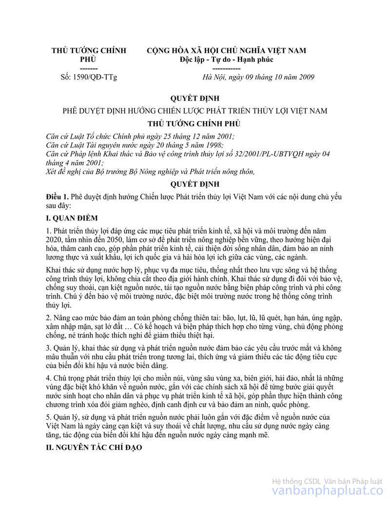
Nội dung toàn văn Decision No. 1590/QD-TTg of October 09, 2009, approving the strategic orientation on development of water resources of Vietnam
THE PRIME MINISTER | SOCIALIST REPUBLIC OF VIET NAM |
No. 1590/QD-TTg | Hanoi, October 09, 2009 |
DECISION
APPROVING THE STRATEGIC ORIENTATION ON DEVELOPMENT OF WATER RESOURCES OF VIETNAM
THE PRIME MINISTER
Pursuant to the December 25, 2001 Law on Organization of the Government;
Pursuant to the May 20, 1998 Law on Water Resources;
Pursuant to April 4, 2001 Ordinance No. 32/ 2001/PL-UBTVQH on Exploitation and Protection of Irrigation Works;
At the proposal of the Minister of Agriculture and Rural Development,
DECIDES:
Article 1. To approve the strategic orientation on development of water resources of Vietnam with the following principal contents:
I. VIEWPOINTS
1. To develop water resources meeting the socio-economic and environmental development objectives through 2020 with a vision towards 2050. which serve as a basis for sustainable agricultural development towards modernization and highly intensive farming, thus contributing to economic development, improvement of people's living conditions, food security and export, national interests and harmony of interests among regions and sectors.
To exploit and use water in a rational and uniform manner for multiple purposes according to river basins and irrigation systems, without division by administrative boundaries. To couple the exploitation and use of water sources with the protection and combat against the degeneration and exhaustion thereof, with the recreation of water sources by construction and non-construction measures. To pay attention to the protection of the water environment, especially the water environment in irrigation systems.
2. To increase safety levels in preventing and combating natural disasters: storms, floods, flash floods, droughts, water logging, sea water infiltration, landslides... To work out appropriate plans and measures for each region, actively preventing, combating, avoiding or adapting to natural disasters in order to minimize damage.
3. To manage, exploit, use and develop water sources to meet immediate requirements not contradictory to future development requirements, adapting to and minimizing the adverse impacts of climate change and sea level rise.
4. To attach importance to the development of water resources in mountainous, deep-lying, remote, border and island regions, particularly those meeting with exceptional difficulties in water sources, in association with social policies in order to incrementally supply water for people's daily life and socio-economic development, contributing to the successful realization of programs on hunger elimination and poverty reduction, sedentarization, and security and defense maintenance.
5. To associate water source management, use and development with the characteristics of Vietnam' water sources, which are increasingly exhausted and qualitatively degenerated while the water use demand keeps increasing and climate change exerts stronger impacts on water sources.
II. GUIDING PRINCIPLES
1. The Government shall perform the unified management of water resources nationwide. The Ministry of Agriculture and Rural Development shall act as the standing body responsible for coordinating with concerned agencies in assisting the Government in performing the state management of water resources.
2. To strictly comply with the Party's guidelines and the State's laws and policies. To step by step improve the system of laws and sub-law documents, mechanisms and policies as well as the system of management agencies from the central to grassroots levels. To enhance the effect and efficacy of state management and heighten the responsibilities of all organizations and individuals for water resources.
3. The strategic orientation on development of water resources of Vietnam through 2020 with a vision towards 2050 shall be materialized in a coordinated manner with different phases and focuses and urgent and long-term contents to ensure sustainable development in the context of climate change and sea level rise.
4. To invest in water resource development for both immediate and long-term socioeconomic benefits under the guiding principle that the State and people join efforts. The State ensures necessary resources while mobilizing contributions of communities, organizations and individuals at home and abroad. To bring into play the community's role and responsibility in managing, operating and maintaining irrigation works. Construction of irrigation works must ensure technical and aesthetic standards, integrated use, harmony with the nature and environmental protection.
5. To fulfill international commitments in the domain of water resources.
III. OBJECTIVES
1. General objectives
- To develop water resources towards modernization and higher capacity to supply water for daily-life, industrial, agricultural, tourist and service activities, assurance of food security and commodity agricultural production in order to raise competitiveness, contributing to sustainable socio-economic development. hunger elimination and poverty reduction.
- To actively prevent, combat and alleviate damage caused by natural disasters, raising the water drainage and anti-flooding capability, protecting the ecological environment and incrementally adapting to climate change and sea level rise conditions.
2. Specific objectives towards 2020 Objective 1: Water supply.
- The water supply rates will reach 90%, with a norm of 120 liters/person/ day. for urban centers of grade IV or higher; 70% from centralized water supply systems, with a norm of 80 liters/ person/day. for urban centers of grade V.
- To ensure water sources for industrial production with a supply norm of 50-100mVday/ hectare of construction, attaching special importance to water-scarce regions in central provinces and the provinces of Ninh Thuan. Binh Thuan, Nha Trang, Vung Tau...
- To supply adequate water for 4.5 million hectares of cultivated land annually (including 3.83 million hectares of paddy), striving to ensure active irrigation of 100% of areas under two rice crops a year (3.32 million hectares), raising the irrigation frequency to 85%.
- To ensure active irrigation and drainage for the development of consolidated fruit tree, aquaculture and salt-making areas.
Objective 2: Water drainage and water environmental protection.
- To actively ensure and increase water drainage frequencies for such big urban centers as Hanoi. Hai Phong. Ho Chi Minh City, Can Tho and Ca Mau. taking into account the impacts of climate change and sea level rise.
- To increase the capability of drainage into main rivers, increasing areas with motor drainage, ensuring water drainage for delta and low-lying regions in service of people's daily life, agricultural production and other industries with an assured frequency of 5 - 10%, suitable to climate change and sea level rise conditions:
+ The northern delta: To ensure water drainage for residential areas and agricultural production areas.
+ The central coastal region: To increase the flood-draining capability for residential areas and areas under summer-autumn and winter-spring crops.
+ The Mekong River delta: To ensure drainage all year round for shallowly submerged areas and the summer-autumn and winter-spring crops for deeply submerged areas.
- To ensure the water environment in irrigation systems up to irrigation standards.
Objective 3: To actively prevent, combat and reduce natural disasters.
- To increase safety level in preventing and combating natural disasters, storms and floods, actively prevent, combat, avoid or adapt to them in order to minimize damage and ensure safety for people.
- To work out anti-flood and-storm construction solutions for ensuring safety for people, protecting 3.83 million hectares of paddy and ensuring stable production development under climate change and sea level rise conditions.
- To incrementally increase the anti-flood capacity of river dike systems in big river basins in the North and northern Central Vietnam with the frequencies:
Main river system | 2010 | 2020 | Notes |
Red and Thai Binh rivers | p = 0.4% | p = 0.2% | In Hanoi |
Ma river | p= 1% | p< 1% | In Giang |
Ca river | p= 1% | p< 1% | In Ben Thuy |
Huong river | p = 5% | p<5% | In Kim Long |
- To proactively prevent, avoid and adapt to floods in order to protect people in other river basins in Central Vietnam, southern central coastal region, the Central Highlands and eastern South Vietnam; to ensure summer-autumn and winter-spring crop production with an assured frequency of 5 -10%.
- To absolutely control floods in shallowly submerged areas in the Mekong River delta, ensuring conditions for adaptability and safety for people's life and production in deeply submerged areas. By 2015, to control big floods similar to those in 1961 on main flows and those in 2000 in intra-fields. After 2015. to continue consolidating works and surrounding dike systems to control floods at higher level.
- The sea and river estuary dike systems will be capable of combating level-9 storms and tides corresponding to the frequency of 5%. in conformity to each phase and the importance of protected areas.
- To ensure safety of reservoirs, dikes, embankments and culverts for river banks and coasts.
Objective 4: To increase the effectiveness of management and exploitation of irrigation works at the level of over 90% of their design capacity.
Objective 5: To raise the water resource science and technology to the average level of Asia by 2020. then the average advanced level of the world by 2050.
IV. TASKS AND SOLUTIONS
1. General tasks and solutions
a/ To intensify organization and management work, to complete mechanisms and policies:
- To supplement and finalize the planning on development of water resources in regions and river basins for multiple purposes, satisfying daily-life, industrial and agricultural water demands, combating water logging, preventing and reducing natural disasters and adapting to climate change and sea level rise. To intensify basic surveys in service of managerial work.
- To complete the system of legal documents: Formulating a law on construction, exploitation and protection of irrigation works and guiding decrees. Prime Ministerial decisions on socialization of rural water supply and environmental sanitation activities: to complete the systems of norms, standards, mechanisms and policies on construction investment, water resource economy, capital raising, prices of water supplied for industrial production, daily-life and service activities.... policies to support farmers participating in the management of small-sized irrigation works.
- To consolidate the system of water resource management organizations:
+ To consolidate the system of organizations performing the state management of water resources from the central to grassroots levels.
+ To consolidate and enhance the capability of Water Resource Planning Management Units of Red-Thai Binh, Dong Nai, Mekong, Ca. Srepok and Vu Gia-Thu Bon river basins and set up Water Resources Planning Management I Inits of Ma. Huong. Kone-Ha Thanh. Tra Khuc and Ba rivers.
+ To enhance the capacity of irrigation work management and exploitation companies; to improve the organizational structures of companies under the Enterprise Law. improve managerial work and operation mechanisms.
+ To further establish, and build operation modes of, organizations cooperating in water use.
b/ Scientific and technological development:
- To study the application of advanced technologies, equipment and materials to surveys, design and construction of irrigation works, and to the adaptation to and reduction of impacts of climate change and sea level rise.
- To study the application of advanced and proper technological solutions for efficient exploitation of water sources in highland and coastal areas, and improvement of alkaline land. To study the application of water-saving irrigating technologies for crops.
- To study the application of, and develop technologies and software for water source assessment, water balance, flow regulation, river management, flood identification and regulation, and the establishment of operation processes for big reservoirs for integrated use; to study river bed deposit and erosion developments; to study proper solutions to control floods and reduce natural disasters in Central Vietnam, coping with climate change and sea level rise; to update and supplement the system of maps on areas prone to Hooding; forecast and warning on regions prone to flash floods.
- To study the manufacture and installation of pumps and small turbines and hydro electric equipment: to use advanced and modern equipment in canal dredging; to install water gauging systems and automatic irrigation systems.
c/ To intensify human resource development:
- To develop new training disciplines and improve training contents and curricula.
- To ensure a balanced and rational structure of training technicians, researchers, managers and skilled workers.
- To develop various forms of training: retraining and postgraduate training, attaching importance to project managers and local planners and managers.
- To train in management capacity building and awareness raising for communities to participate in community-based management and exploitation of irrigation works and management and reduction of natural disasters.
d/ To concentrate investment on the construction and completion of irrigation works:
- To formulate investment plans: To formulate investment plans for central and key works, especially incorporation of programs on agricultural, forestry and fishery development and rural development, for coordinated support and avoidance of overlapping investment, in order to promote effectivenesss and attain the socio-economic development objectives of the whole country and each region in each period.
- To concentrate on upgrading the existing irrigation systems: completing investment in each system, upgrading and modernizing major works, canals and operation equipment in order to bring into play their designed capacity and raise their service capacity.
- To continue constructing small irrigation works in highland, deep-lying, remote, border and island areas to supply water for irrigation and daily-life activities.
- To develop water resources in service of aquaculture. industrial production, daily-life activities and improvement of the coastal environment.
- To construct big works to regulate floods, control sea tides, prevent infiltration of sea water, retain freshwater and drain floods, limiting the impacts of climate change and sea level rise.
- To incrementally study and apply measures to adjust and stabilize river beds, river mouths and coasts, controlling river mouth deposit.
- To tap the potential of irrigation works in service of tourism and supply of water for daily life and industrial production in order to create funds for work maintenance and operation management.
- To intensify the management, control and supervision of sources of wastewater discharged from industrial parks and urban centers, which pollute irrigation systems. To build water quality control systems in irrigation systems.
- To materialize the national strategy on natural disaster prevention, combat and reduction through 2020. the program on reservoir safety, the planning on flood prevention and combat for the Red river-Thai Binh river system, the Mekong River delta water resource planning, the program on upgrading of sea dikes and related programs and schemes already approved by competent authorities.
+ To implement programs on building of hard dike surfaces, planting of break-water bamboos and anti-erosion grasses, on upgrading and construction of dike culverts, consolidation of weak dike foundations, management of rivers, and dredging for flood drainage in the immediate period, while upgrading them in light of climate change and sea level rise conditions.
+ To warn of flash floods and work out appropriate measures to protect people and production in areas highly prone to flash floods.
+ To build spillways for reservoirs and prepare anti-tlood schemes to ensure safety of works in rainy seasons.
+ To draw maps on flooding-prone areas in river basins.
+ To further construct storm shelters for vessels according to plan.
+ To protect and develop forests and breakwater trees for sea dike protection.
+ To enhance the capacity of the Storm and Flood Prevention and Combat Command and raise the quality of flood warning. To finalize the process of operating inter-reservoirs in the Red river- Thai Binh river basin and establish an operation process for inter-reservoirs in other big river basins.
e/ To intensify international cooperation
- To intensify cooperation in the exploitation of water sources from international rivers (Mekong. Red river...) on the principle of cooperation, equality, sustainable development and mutual respect for interests of parties.
- To further expand international cooperation in the fields of institution and water source and irrigation work management.
- To fully tap international organizations' cooperation, support, technological transfer and finance for water resource development and water source protection.
f/ Capital raising and intensification of community participation
- To formulate capital raising mechanisms in line with the development trend with a view to mobilizing every capital source: state budget, foreign loans, capital from organizations, individuals and people in benefiting regions under the guiding principle of joint efforts of the State and people, promotion of domestic resources and strength of the entire society.
- To intensify propagation and education work to raise community awareness of participation in the community-based management, exploitation and protection of irrigation works as well as natural disaster control and reduction.
2. Water resource development tasks and solutions for each region
The water resource development tasks and solutions for each region are listed in the Appendix.
3. Adaption to climate change and sea level rise
Main water resource development solutions aiming for adaptability to the impacts of climate change and sea level rise:
- To study and assess the impacts of climate change and sea level rise on the irrigation systems, especially in regions prone to the greatest impacts of climate change and sea level rise such as the Red river delta, central coast and Mekong River delta.
- To study and apply new designing criteria in order to ensure the water supply and drainage as well as flood combat suitable to climate change and sea level rise conditions.
- To review and supplement planning, incrementally building works at big river estuaries to prevent sea water infiltration, retain freshwater and drain flood water suitable to climate change and sea level rise conditions, especially in regions prone to the greatest impacts of climate change and sea level rise such as the Red river delta, central coast and Mekong river delta.
- To construct or upgrade systems of sea dikes, river dikes and estuary dikes, ensuring safety for people's daily life and production.
- To formulate programs for upgrading the irrigation systems in service of water supply and drainage and work safety maintenance.
- To study and apply advanced solutions and technologies to water supply and drainage and irrigation work management and operation, aiming to limit the adverse impacts of climate change and sea level rise.
V. PLANS OF ACTION
From now through 2020, to focus the direction on implementation of the following programs:
1. Program on management intensification
To promote planning and management work, finalize mechanisms and policies and consolidate organizations for rational and economical use and exploitation and effective service of various socio-economic sectors in the immediate future, which is not contradictory to long-term development requirements, including:
- Elaborating an irrigation law, reviewing, revising and supplementing relevant legal documents.
- Formulating and improving systems of technical norms and standards.
- Formulating and completing mechanisms and policies for construction, management, exploitation and protection of irrigation works.
- Consolidating system of water resource state management organizations.
- Consolidating and building capacity of Water Resource Planning Management Units.
- Improving the structure of management and exploitation of works.
- Elaborating a master plan on water resources in socio-economic regions, suitable to climate change and sea level rise conditions.
- Planning water resources in service of water drainage and anti-flooding work for urban centers and residential quarters.
- Reviewing, supplementing and adjusting the planning on water resources for river basins and territorial regions.
- Reviewing, supplementing and adjusting the planning on irrigation systems.
- Conducting basic surveys on water resources.
2. Program on scientific and technological development
To increase the level of water resource science and technologies to Asia's average level by 2020, concretely: To conduct scientific and technological research in service of water supply and drainage, actively prevent, combat and reduce natural disasters and adapt to climate change and sea level rise; to apply new technologies and new materials, establishing databases on advanced technologies in service of the planning, designing, management and operation of irrigation systems towards modernization, sustainable development and adaptability to climate change and sea level rise, including:
- Research and application of advanced technologies, equipment and materials to project survey, designing and construction.
- Research, application and development of technologies, calculation and forecasting software.
- Research and application of advanced and modern equipment in service of management and operation.
- Research and application of advanced water resource solutions and technologies in service of highland, coastal and island regions.
- Research and application of water-saving irrigating technologies for cultivated crops.
3. Program on human resource development
To quantitatively and qualitatively develop human resources capable of approaching and applying scientific and technological advances to water source development and protection and rational distribution to meet local demands, including:
- Improvement of training programs.
- Training and capacity building for researchers, designers, constructors and managers.
- Training and capacity building for communities to participate in irrigation work management, exploitation and protection.
- Information and propagation on the mass media.
4. Program on upgrading and modernization of irrigation systems
To raise the water supply stability and efficiency with less water loss and thrifty use of existing works, through:
- Completion of irrigation systems, renovation and upgrading of key works and main canals.
- Completion of intra-field canal systems.
- Modernization of management and operation equipment.
5. Program on upgrading and development of big reservoirs for multiple purposes
To upgrade the existing reservoirs with guaranteed work safety, to build big reservoirs for water supply, flood combat, electricity generation and maintenance of the downstream ecological environment, aiming to satisfy increasing demand for water for socio-economic development and to adapt to climate change.
6. Program on water resource development to serve the restructuring of agriculture-forestry-fishery- rural economy
To review, adjust and supplement planning on and develop water resource infrastructure works in service of the restructuring of agriculture-forestry-fishery-rural economy, including:
- Aquaculture and salt production.
- Consolidated fruit tree regions.
- Water supply for crops and consolidated industrial crop areas.
7. Program on development of mountain and island irrigation and small hydroelectric stations
To serve people's daily-life activities and production in mountainous, deep-lying, remote, border and island regions, contributing to achieving hunger elimination and poverty reduction targets, population stability, security and defense maintenance, including:
- Daily-life water supply for highlanders, border inhabitants and islanders.
- Small irrigation works to supply water for daily life and production activities.
- Irrigation-cum-small hydroelectric stations.
8. Program on rural clean water and environmental sanitation
To supply water for daily life, improving the living conditions and health for people and minimizing rural environment pollution.
To realize the approved national strategy on rural water supply and environmental sanitation.
9. Program on natural disaster prevention, combat and reduction and adaptability to climate change
To study and apply measures to raise the water supply and drainage and anti-flood capacities of irrigation systems for active prevention, combat or adaptability and avoidance in order to mitigate damage caused by natural disasters, protect people and serve socio-economic development, adaptable to climate change and sea water rise conditions.
To integrate it with the implementation of the approved national strategy on natural disaster prevention, combat and reduction, deploying the following programs on:
- Consolidating and raising the anti-flood capacity of irrigation systems.
- Consolidating and raising the water supply and drainage and anti-flood capability of irrigation systems.
- Building or upgrading irrigation systems to serve water drainage, flood combat for urban centers and concentrated residential quarters.
- Building in big river estuaries breakwater facilities to control tides, prevent sea water infiltration and retain freshwater.
Article 2. Organization of implementation
1. Based on the above objectives, tasks, solutions and action programs, the Ministry of Agriculture and Rural Development shall assume the prime responsibility for performing the following specific tasks:
- Guiding, inspecting and urging localities in the implementation of the strategic orientation; acting as the national coordinator for contact with international organizations in this domain.
- Drawing up specific action plans clearly defining necessary priority contents and assigning implementation tasks to sectors and localities.
- Organizing the inspection and examination of the implementation of the strategic orientation; to preliminarily review the implementation every five years, drawing experiences and proposing to the Prime Minister the adjustment of contents and solutions in the strategic orientation to suit the new situation.
2. Ministries, branches and localities shall, depending on their respective functions and assigned tasks, efficiently realize the contents, objectives, tasks and solutions stated in the strategic orientation which are related to them.
3. The Ministry of Planning and Investment shall assume the prime responsibility for, and coordinate with the Ministry of Finance, the Ministry of Agriculture and Rural Development and concerned ministries and branches in, balancing plans and arranging annual investment capital under the State Budget Law and other aid capital sources for the effective realization of the strategic orientation.
4. Provincial-level People's Committees shall, depending on their delegated powers and assigned responsibilities, direct authorities at different levels and branches to realize the orientation; incorporate the above-said contents into their local socio-economic development planning and plans; and annually report on implementation results to the Ministry of Agriculture and Rural Development.
Article 3. This Decision takes effect on the date of its signing.
Article 4. Ministers, heads of ministerial-level agencies, heads of government-attached agencies and chairpersons of provincial-level People's Committees shall implement this Decision.
| FOR THE PRIME MINISTER DEPUTY |
APPENDIX
TASKS OF AND SOLUTIONS TO WATER RESOURCE DEVELOPMENT FOR EACH REGION
(To the Prime Minister's Decision No. 1590/ QD-TTg of October 9, 2009)
1. The northern midland and mountainous region:
a/ Water supply and drainage:
-To coordinate with ministries, branches and localities in speeding up the construction of big irrigation works for integrated use on Da, Lo, Cau and Luc Nam rivers.
- To study and apply solutions to supplying daily-life water for highland and border inhabitants, particularly those in Ha Giang. Cao Bang. Lao Cai and Lai Chau provinces.
- To address the question of water drainage for Phu Tho region, protect dike-outside communes of Bac Giang province and other regions frequented by flooding.
b/ Natural disaster prevention, combat and reduction:
- To warn of regions highly prone to flash floods, applying proper measures to protect people and production in the provinces of Son La, Lai Chau, Hoa Binh, Tuyen Quang. Ha Giang, Cao Bang. Bac Kan and Thai Nguyen.
- To consolidate dikes of the Red river system in the provinces of Hoa Binh. Tuyen Quang and Phu Tho to be capable of coping with floods corresponding to the Red river water level of + 13.10 m at Long Bien station: dikes of the Thai Binh river system in the provinces of Thai Nguyen and Bac Giang to be capable of coping with floods corresponding to the Thai Binh river water level of +7.20 m at Pha Lai station.
- In the immediate future, to consolidate Quang Ninh sea dikes to be capable of coping with tides of 9% frequency in combination with 9-level storms, a number of sea dike sections protecting residential areas and key economic regions against level-10 storms, upgrade them to suit the situation of climate change and sea level rise.
- To consolidate and maintain the stability of border river beds and banks.
c/ Water source management and protection:
- To further manage water source planning and exploitation, inspect and oversee sources of wastewater discharged from industrial parks and urban centers, particularly in the areas of Thai Nguyen (into Cau river), Bac Giang (intoThuong river), Viet Tri (into the Red river) and Hon Gai-Cam Pha (into the sea).
- To consolidate and promote the role of Water Resource Planning Management Units of the Red river-Thai Binh river basin and Cau river sub-basin.
- To build and consolidate stations for regular water quality assessment, particularly stations near the border.
d/ Projected works under planning:
- Water supply: To repair and upgrade 7,394 works (currently irrigating 189,485 ha) to irrigate 242.475 ha. To build 5,308 new ones for irrigating 129,552 ha.
- Water drainage: To repair and upgrade 103 drainage works (currently draining water for 31,760 ha) to drain water for 41,468 ha. To build 84 new ones to drain water for 16. 894 ha.
2. The northern delta region:
a/ Water supply and drainage:
- To renovate, upgrade and modernize the irrigation systems of Bac Hung Hai. Nhue river, northern Nam Ha... for stable irrigation and drainage for 860.000 ha with a frequency of 85%, improving soil with alluvia and expanding areas under the winter crop to facilitate the crop restructuring (expanding the irrigated area along the Red river banks to around 4().(K)0 ha).
- To actively drain water for Hanoi capital.
- To add water supply works in the regions of Bac Hung Hai. Tich river. Day river. An Kim Hai, northern Duong...
- To add water sources for the Hanoi-Quang Ninh-Hai Phong economic triangle, and other industrial parks and urban centers.
- To complete projects on Day river flow clearance, incrementally improving Day river to create a constant flow to meet socio-economic development and environmental protection requirements.
- To address the question of water drainage for the regions of Nhue river, Bac Hung Hai. Ngu Huyen Khe.... and other flooding-frequented regions in the direction of intensifying water drainage by the pump system directly into main rivers, meeting the drainage requirements under the impacts of climate change and sea level rise.
b/ Natural disaster prevention, combat and reduction:
- To consolidate dikes of the Red river and Thai Binh river systems to be capable of coping with floods corresponding to the Red river water level of +13.10 m at Long Bien station and the Thai Binh river water level of +7.20 m at Pha Lai station. In Hanoi, to be capable of coping with floods corresponding to the Red river water level of +13.40 m at Long Bien station and draining water at least 20,000 mVsecond.
- To abolish the flood-slowing areas of Luong Phu. Quang Oai, Tarn Thanh and Lap Thach, complete dikes on the right bank of Day river, and upgrade dikes on the left bank of Day river and Day sluice gate. To revive Day river.
- To complete the process of inter-reservoir operation for integrated use in the Red river and Thai Binh river basins.
c/ Water source management and protection:
To enhance the management of water source planning and exploitation, to inspect and oversee sources of wastewater discharged from industrial parks, urban centers and craft villages, which pollute the irrigation systems of Nhue river, Bac Hung Hai, northern Duong, northern Nam Ha, An Kim Hai....
d/ Projected works under planning:
- Water supply: To repair and upgrade 201 works to irrigate 86,171 ha; to build 81 new ones which will irrigate 36.376 ha. Some main works:
Works on branches of the Red river and Thai Binh river: To construct Dao river sluice gate on Dao river. Nam Dinh. To study the construction of Do Han sluice gate on Thai Binh river and Hoa river sluice gate on Hoa river.
Source-supplementing works: To complete the construction of Tac Giang and Hat Mon- Cam Dinh sluice gates. To continue with the construction of Luong Phu and Lien Mac sluice gates to supplement water sources in areas on the right bank of the Red river, Xuan Quang 2 (Lien Nghia) sluice gate to supply water for Bac Hung Hai area. Tan De and Phu Lac sluice gates to supply water for Thai Binh region. Song Moi sluice gate to supply water for Tien Lang area. To rebuild Bang Lai and Quang Dat sluice gates, creating water sources for An Kim Hai area.
- Water drainage: To repair and upgrade 618 works to drain water for 344.684 ha. to build 161 new ones ensuring water drainage for 145.504 ha. Some main works:
In the Phan and Ca Lo river area: To build the pump stations of Nguyet Due and Ngu Kien to drain water up to 100 mVs directly into the Red river; to build regulatory sluice gates at Cau Ton river and Ca Lo river T-sections and dredge main rivers to ensure drainage for 41. 530 ha.
In the Nhue river area: Upon the completion of Yen So 2 pump station, to continue with the construction of Yen So 3 pump station with the drainage capacity of 55 m3/s. To rebuild Dong My pump station of 35 m3/s; to build Nam Thang Long pump station of 9 m3/s. Lien Mac station with the drainage capacity of 170 nrVs to drain water into the Red river. Yen Nghia pump station of 120 mVs and Yen Thai-Dao Nguyen pump station of 54 mVs to drain water into the Day river. To build Ngoai Do I and II pump stations to drain water for 9.220 ha and Lac Trang III pump station to drain water for 2.044 ha and irrigation for 792 ha.
In the area of six pump stations of Nam Ha: To build new water-draining pump stations of Kinh Thanh II, Song Chanh II, Vinh Tri III and Co Dam II.
In Bac Hung Hai area: To build the water-draining pump station of Tu Dinh (Long Bien). ensuring drainage for 3.500 ha of Long Bien district; Me So station ensuring drainage for 3.756 ha in Van Giang area. Nghi Xuyen drainage-cum-irrigation pump station for 13.280 ha, southern Ke Sat pump station to drain 27.057 ha of An Thi area, a part of southwestern Cuu An sub-region and southeastern Cuu An region.
3. The northern Central Vietnam:
a/ Water supply and drainage:
- To focus on upgrading key works, solidifying and incrementally modernizing existing systems and completing the construction of dam sluice gates to prevent infiltration of sea water, drain floods and keep freshwater in river estuary areas such as Do Diem. Len ri ver dam....
- To complete the construction of Cua Dat. Ta Trach and Binh Dien projects, build Ban Mong. Ngan Truoi, Thac Muoi and Chuc A reservoirs and small- or medium-sized reservoirs for active water regulation, electricity generation and flood reduction for downstream regions.
- To attach importance to the development of water resources in the areas of Ho Chi Minh road corridor and Vietnam- Laos border region. To study irrigation solutions against desertization of sand areas.
- To prevent and combat flooding for cities, towns and concentrated residential areas such as LeThuy, Hai Lang and Phong Dien-Quang Dien.
b/ Natural disaster prevention, combat and reduction:
- To consolidate dikes along Ma and Chu rivers to be capable of coping with floods of 1% frequency in Ly Nhan and Giang on Ma river, floods of 0.6% frequency in Xuan Khanh on Chu river. To complete Cau Dat project to be capable of coping with floods of 1 % frequency after 2020.
- To consolidate dikes along Ca and La rivers to be capable of coping with floods of 1% frequency at Nam Dan hydrological station. To complete Ban Ve project, and build Ngan Truoi, Thac Muoi, Ban Mong and Chuc A reservoirs in service of water supply, electricity generation and flood combat for downstream areas, which will be capable of coping with floods of 1% frequency after 2020.
- To consolidates dikes of Ca river's branches and river dikes from Ha Tinh to Thua Thien Hue against summer-autumn floods and late floods. To actively prevent and avoid or adapt to floods in high season.
- To consolidate sea dike systems against 5%-frequency tides coupled with level-10 storms in Nghe An and Ha Tinh provinces, level-9 storms and 10% floods in Quang Binh, Quang Tri and Thua Thien Hue provinces, and in Thanh Hoa, against storms of level 9,10 or 12, depending on each dike section (under Decision No. 58/2006/ QD-TTg).
c/ Water source management and protection:
- To organize and promote the role of Water Resource Planning Management Units of Ma, Ca and Huong rivers.
- To formulate the inter-reservoir operation process for Ma, Ca and Huong river basins.
d/ Projected works under planning:
Water supply: To repair and upgrade 1,865 works to irrigate 292,504 ha, and build 1,139 new ones to irrigate 223.286 ha. Some main works:
Cua Dat reservoir supplementing water sources for Bai Thuong dam to irrigate and create water sources for nearly 50,000 ha of cultivated land and aquaculture; to irrigate the land areas previously irrigated by Muc river and Yen My reservoirs which will function to supply water for Nghi Son industrial park.
To construct a system conducting water from Cua Dat reservoir via Doc Cay to irrigate and create water sources for 29.196 ha, including 10,942 ha formerly irrigated by southern Ma river pump station.
To construct a sea water-preventing dam on Len river to create water sources for Ha Trung and Nga Son areas and Hau Loc sea area.
To construct Ban Mong reservoir to irrigate 18.870 ha; Thac Muoi reservoir, 10,500 ha; Chuc A reservoir; 6.000 ha; and Da Gan reservoir, 6,500 ha.
To upgrade My Trung sluice gate to prevent tides and drain water for Kien Giang delta region. To construct Thac Chuoi reservoir supplementing water sources for Da Mai dam. directly irrigating 1,055 ha and creating water sources for over 300 ha under aquaculture.
- Water drainage: To repair and upgrade 225 works to drain water for 278,728 ha, to build 89 new ones to drain water for 62.082 ha. To prioritize the dredging of main rivers and the construction of sluice gates and pump stations to drain water for some 50,433 ha. largely in Thanh Hoa with 21,250 ha, Nghe An with 4.800 ha, Ha Tinh with 8,050 ha, Quang Binh with 7,500 ha, Quang Tri with 2,300 ha and Thua Thien Hue with 6.433 ha.
4. The southern Central Vietnam
a/ Water supply and drainage:
- To upgrade, complete and solidify work systems: Thach Nham, Tan An- Dap Da and Lai Giang and the system using freshwater behind the Hinh river hydro power plant....
- To build and complete big works for integrated use: Tranh river 2, A Vuong 1, Dac Drinh, Dong Mit. Dinh Binh, Tro river 1, Ba Ha. Ea Krong Ru rivers... in service of electricity generation, irrigation and water supply for daily life, industrial production, tourism, flood reduction, improvement of the ecological environment in downstream areas.
- To drain floods for low-lying areas downstream Thoa and Tarn Ky rivers, and coastal urban centers.
b/ Natural disaster prevention, combat and reduction
- To actively prevent, avoid or adapt to floods in high season, building reservoirs and systems of early flood-preventing and season-end flood-draining facilities to ensure winter-spring and summer-autumn crop production at the level of 10 + 5%.
- To study and apply measures to stabilize river beds, adjusting rivers and combat deposit in the mouths of Thu Bon, Ba, Lai Giang, Tra Khuc, Tra Cau, Ban Thach, Cai Nha Trang rivers and along the coast.
- To consolidate sea dikes in Da Nang city and Quang Nam province to be capable of coping with tides of 5% frequency and storms of levels 9 and 10, depending on the position of each dike section (under Decision No. 58/2006/QD-TTg).
c/ Projected works under planning:
- Water supply: To repair and upgrade 130 works to irrigate 91,968 ha, including additional 37, 113 ha. To build 126 new ones to irrigate 83.319 ha. Some main works:
Van Phong system to supply water for 7,263 ha north of Kon river.
To construct Thuong Son canal conducting water from An Khe-Ka Nac reservoir to irrigate 3.500 ha of sugarcane in the highland area south of Kone river.
To construct Dong Mit reservoir for irrigation of 250 ha, electricity generation Nlm = 13.84 M W, adding 124 x 106 m3 of water for Lai Giang dam and jointly combating floods for downstream areas of Lai Giang river with Wpl = 40 x 106 m3.
To construct Cho river reservoir 1 for irrigation of 2.560 ha, daily-life water supply of 50,000 m3/day. electricity generation with Nlm = 7MW, additional supply of 4.2 m3/s in 8 dry-season months to improve the flow and environment downstream Cai Nha Trang river.
To construct Dong Dien reservoir for irrigation of 1,700 ha and daily-life and industrial water supply for Van Phong industrial park with 135,000 m3/day.
- Water drainage and flood combat: To upgrade 52 existing works and build 125 new ones with VND 10,857 billion in investment.
5. The Central Highlands
a/ Water supply and drainage:
- To speed up the construction of big works for integrated use on Se San, Srepok, Ba and Dong Nai rivers for water supply, flood combat, electricity generation....
- To concentrate investment on the construction and completion of big irrigation works playing a leading role in supplying water for production such as downstream Krong Buc. upstream Krong Pach. Krong Nang, EaMo. Ea-Thul, Ea-Mla....
- To further build small- and medium-sized works for daily-life and production water supply, particularly for people in resettlement areas, deep-lying and remote regions and areas along Ho Chi Minh road, ensuring water for the summer-autumn crop production and increasing areas of cultivation land in dry season.
- To study and rationally tap underground water for people's daily life and crop irrigation.
b/ Natural disaster prevention, combat and mitigation:
- To invest in the completion and consolidation of dike systems protecting summer-autumn and winter-spring crop production for Lak-Buon Trap and Cat Tien-Dahoai-Date areas.
- To properly restructure crops in regions frequented by serious flooding in the summer-autumn crop season.
c/ Projected works under planning:
- Water supply: To repair and upgrade 364 works to irrigate 79,145 ha and build 1,644 new ones to irrigate 407,776 ha.
- Water drainage and flood combat: To build 35 works worth VND 7,183 billion.
6. The eastern South Vietnam
a/ Water supply and drainage:
- To build and complete the big integrated-use works of Tan My, Ta Pao, Luy river, Phuoc Hoa, Ray river, Vo Dat... in service of agriculture, people's daily life and industry (especially works to supply water for the Ho Chi Minh city-Ba Ria Vung Tau-Dong Nai industrial triangle), electricity generation, aquaculture. flood reduction and environment improvement.
- To build medium-sized works in service of agriculture and daily life, including Dinh river reservoir. Tarn Bo, Suoi Ca, Phuoc Thai, Thien Tan pump station, Dong Phu reservoir complex. Tan Hung facility, the system of pump stations right of Tay Ninh, Ben Than pump station... and small works.
- To supply water for business households in coastal areas, particularly industrial parks, tourist resorts, aquaculture and desertization combat.
- To drain and combat flooding for Ho Chi Minh City.
- To study and apply measures for inter-reservoir operation.
- To speed up the construction of big integrated-use works on the main flows of Dong Nai 3, Dong Nai 4, La Nga 3...
- To rationally tap underground water sources in service of industry, people's daily life and crop irrigation.
b/ Natural disaster prevention, combat and reduction:
To build a complete system of dikes and embankments to protect cities, towns and concentrated population areas.
c/ Water source management and protection:
To consolidate and promote the role of the Dong Nai River Water Resource Planning Management Unit.
d/ Projected works under planning:
- Water supply: To repair and upgrade 259 existing works and build 802 new ones on small rivers and streams for irrigation of 342,082 ha. water supply of 919.600 mVday and electricity generation of 451 MW.
- Water drainage and flood combat: To construct 138 works in service of drainage and prevention of sea water infiltration for 153.128 ha. To upgrade and build 203.32 km of dikes and 54 coastal embankment works.
7. The Mekong River delta
a/ Water supply and drainage:
For unflooded areas:
To continue with the program on freshwater retention in combination with fishery development, road and waterway transport and rural development:
- To complete the systems of sea water-freshwater zoning on the basis of the orientation for land use and crop as well as husbandry restructuring.
- To build and dredge main canals conducting freshwater from Tien and Hau rivers while building sluice gates and sea dikes, incrementally conducting freshwater to areas not yet irrigated with freshwater such as the coastal districts of Bac Lieu, Soc Trang, Tra Vinh, Ben Tre and Ca Mau.
- To study the construction of systems of sea water-preventing and freshwater-retaining sluice gates on Cai Lon, Cai Be and Vam Co rivers. To study schemes to actively supply freshwater for Ca Mau peninsula, meeting increasing water demands of various social and economic sectors.
- To complete freshwater supply systems for the areas of Go Cong. Ba Lai. southern Mang Thit, expanded Quan Lo-Phung Hiep and O Mon-Xa No (after the review of Decision No. 99/TTg);
- To improve and develop water drainage and flooding combat systems for Can Tho, Vinh Long and Ca Mau cities and other towns in the delta region.
- To study and arrange irrigation systems suitable to the particularities of regions permitted for production restructuring, particularly the development of shrimp farming and shrimp farming-cum-paddy cultivation.
- The flooded regions:
- Deeply flooded regions: To develop systems of works in service of irrigation, drainage, daily-life water supply and environmental protection for residential areas, schools, infirmaries, towns, townships and populated areas, depending on each area's conditions, to ensure safety and hygiene, especially in flood seasons.
- Shallowly flooded regions: To develop systems of works for active control of irrigation and drainage in service of year-round production.
b/ Natural disaster prevention, combat and reduction:
- General orientations for the whole region:
- To consolidate and develop the system for Long Xuyen quadrangle flood drainage into the western sea, the anti-flood system in the area between Tien and Hau rivers. To complete the system to control floods from Cambodia into Vietnam; to enhance the systems of flood drainage from Dong Thap Muoi (the Plain of Reeds) into Tien and Vam CoTay rivers, aiming to prevent early floods, ensuring safety for summer-autumn rice crop harvest while quickly draining floods for the winter-spring rice crop. To finalize the planning on construction of floating population clusters to stabilize their lives in flooded regions.
The deeply flooded region:
- To continue consolidating and building canal embankments and population clusters with a view to protecting safety for people's lives in flood seasons.
- To develop flood control systems in parallel with systems for control of irrigation, drainage, daily-life water supply, environmental protection and fishery development in flooded regions: To build and complete the flood control systems for Long Xuyen quadrangle and Dong Thap Muoi areas. To consolidate systems of embankments and sluice gates in deeply flooded region, ensuring the timely harvesting of the summer-autumn paddy crop and paddy on three-crop areas.
- To build and complete the irrigation systems for active supply of water upon water shortage and drainage upon late and prolonged floods.
- To improve canals and channels, enhancing their flood drainage capacity, and creating ecological lakes.
- The shallowly flooded region:
- To build systems of surrounding dikes for absolute flood control to safely protect areas under paddy, fruit trees and cash crops.
- To build irrigation systems in association with waterway and roadway transport and rural development.
- To manage rivers: To study and apply measures against land erosion and slides on Tien and Hau river banks and some coastal areas. To quickly relocate people from areas hit by serious erosions and slides.
c/ Water source management and protection:
- To establish advanced and modern systems for qualitative and quantitative observation of water in the irrigation systems: southern Mang Thit. Quan Lo-Phung Hiep. O Mon-Xa No. Dong Thap Muoi and Long Xuyen quadrangle.
- To formulate schemes on rural water supply and sanitation, especially in flooded regions.
- To set up appropriate management organizations and formulate regulations on operation of such big systems as Long Xuyen quadrangle, Quan Lo-Phung Hiep. southern Mang Thit. Dong Thap Muoi. O Mon-Xa No. Ba Lai. and Tra Su-Tha La.
- To adjust and supplement the master plan on water resource development of the Mekong River delta for adaptability to climate change conditions and use of water in upstream countries.
- To develop crops and husbandry suitable to conditions of each region.
d/ Projected works under planning:
- Irrigation, drainage, water supply, prevention of sea water infiltration and soil improvement
The region on the left bank of Tien river
The sub-region south of Nguyen Van Tiep canal: To dredge Bao Dinh, Xuan Hoa and Road 14 canals in service of irrigation and drainage for Bao Dong and Go Cong areas. To dredge, and complete the surrounding dikes along banks of, main canals linking Tien river with Nguyen Van Tiep canal in service of irrigation, water and flood drainage.
The sub-region north of Nguyen Van Tiep canal: To dredge, upgrade the canals of So Ha-Cai Co-Long Khot, Tan Thanh-Lo Gach. Hong Ngu. An Binh. Dong Tien-La Grange, canal 79. An Phong-My Hoa-Bac Dong and Nguyen Van Tiep canal in service of irrigation and drainage. To dredge main canals in Tu Thuong area for irrigation, water and flood drainage into Tien river.
Area between Vam Co Dong and Vam Co Tay rivers: To conduct water from Vam Co Tay river (with Hong Ngu canal conducting water from Tien river). To dredge and build Canal 61-Bo Bo and transversal canals linking Vam Co Dong and Vam Co Tay rivers in service of intra-field irrigation and drainage.
To build canals of grades 2 and 3 in service of irrigation, water and flood drainage and alkaline soil improvement.
To continue with the construction of sea water prevention, water supply and drainage sluice gates along Vam Co Dong and Vam Co Tay rivers.
To build the ecological lakes of Lo Moi (Tan Phuoc), Lang Sen (Moc Hoa) and Cham Chim (Tarn Nong) for ecological environment protection, sub-climate improvement, humidity maintenance and water supply for Dong Thap Muoi in the dry season.
Region between Tien and Hau rivers
Northern Mang Thit sub-region: To combat floods all year round for the area from Mang Thit canal to Vinh An canal, to dredge canals of grades 1 and 2. linking Tien and Hau rivers for irrigation and drainage. To build surrounding dikes for protecting fruit tree gardens and improving intra-field systems in service of freshwater aquaculture. To combat August floods for the area upstream Vinh An canal, to bui Id systems of anti-flood surrounding dikes and intra-field canals for water supply and drainage to protect winter-spring and summer-autumn crops.
Southern Mang Thit sub-region: To continue with the implementation of approved projects, renovating one-way sluice gates into two-way ones for higher capacity to receive freshwater, raise underground water level, restrict alkality and serve aquaculture.
Ben Tre sub-region: Mo Cay-Thanh Phu area: To dredge main rivers, complete flood-control surrounding dikes, build intra-field sluice gates in service of production and fruit tree planting in freshwater areas north of Mo Cay canal. In the area from southern Mo Cay canal to Thanh Phu dike, to build dikes south of Thanh Phu, sea water prevention sluice gates along Co Chien and Ham Luong rivers and intra-field works for irrigation and drainage. In area east of Thanh Phu. to build a system of irrigation works for aquaculture; in the Giong Trom-Ba Tri-Binh Dai area: the area north of Giao Hoa-Chet Say canal is a brackish water area, to dredge upstream Ba Lai river and build a system of dikes, sluice gates, intra-field for fruit tree planting and two rice crops and one subsidiary food crop. In the area from south of Giao Hoa-Chet Say canal to Binh Dai dike, to build a system of dikes, sea water control sluice gates along Cua Dai and Ham Luong river. To build sluice gates and dry docks of Ben Tre and Giao Hoa for fruit tree development and two rice crop plus one subsidiary food crop production. In the area east of Ba Tri and Binh Dai dikes, to build irrigation systems for aquaculture.
Long Xuyen quadrangle
To upgrade or build main canals and grade-1 canals for irrigation, drainage and soil improvement with alluvia.
The Rach Gia-Ha Tien coastal area will be controlled from sea water by coastal sluice gates and canals. To build Vam Rang sluice gate for sea water control.
Ca Mau peninsula
To build the Quan Lo-Phung Hiep sea water-freshwater division boundary system.
To dredge and expand main canals and grade-1 canals for agricultural production and aquaculture. To build surrounding earth embankments in combination with rural transport.
To build sluice gates to the south of Ganh Hao river in Ca Mau province.
To build sluice gates along Cai Long-Cai Be rivers and north of Ong Doc river.
To build sluice gates along Hau river from Dai Ngai to Rach Vop for water supply, sea water prevention and water drainage.
To consolidate systems of sluice gates and dikes surrounding U Minh Thuong and U Minh Ha forests to attain water.
To complete the surrounding dikes, build sluice gates and canals of grades 2 and 3 for water supply and drainage in areas along Hau river banks.
To build irrigation systems for aquaculture in brackish water areas.
To build works on Cai Lon and Cai Be rivers for tide control, sea water prevention, freshwater reserve and water drainage.
- Natural disaster prevention, combat and reduction
Long Xuyen quadrangle
To continue building and completing flood control systems, including the dike system from Ba Chuc to the head of Ha Giang canal to prevent floods flowing across the border; build new flood control facilities at the heads of canals Moi, T5, T4. T3, T2. Nong Truong,..; to renovate, upgrade or build canals of grades 1 and 2 for irrigation, water and flood drainage into the western sea: build new sluice gates along Hau river and at the heads of main canals for flood prevention and drainage and water reserve in dry season. To build flood control facilities to protect cities, towns and residential areas.
Western Hau river
To control floods from Hau river for active alluvium retention. To drain water into Cai Lon river through tide prevention and water drainage facilities along Cai Lon river.
To build a system of works to control floods all the year round for intra-field areas, including protection dikes around small- and medium-sized square areas for Can Tho-Long My sub-region; small-sized square areas in the east of national highway 91; surrounding protection dikes built in Cai San-Thot Not, Thot Not-0 Mon and O Mon-Xa No areas in the west of national highway 91 in the Cai San-Xa No sub-region.
Dong Thap Muoi (Plain of Reeds)
To build flood prevention and control lines south of Tan Thanh-Lo Gach canal in combination with the relocation of people into border defense lines. To expand flood drainage gates cum viaducts for flood drainage into Tien river on the Nam So Thuong road. To dredge and expand Tan Thanh-Lo Gach canal. To build under-dike culverts for flood control and water taking.
To dredge and expand main canals and canals along Tien river in order to raise the capacity of flood drainage into Tien river and form flood control banks along main canals.
To dredge and expand Bo Bo canal and those canals linking Vam Co Dong and Vam Co Tay rivers, forming closed blocks in service of the production of such industrial crops as sugarcane, pine apple and banana.
To build systems of surrounding dikes and under-dike sluice gates to protect townships, commune centers and residential clusters in flood season.
Region between Tien and Hau rivers
Area north of Vinh An canal: to combat floods in August; area from Vinh An canal to Mang Thit canal: to control floods all year round. Areas surrounded by blocks will range from 200 to 1.000 ha. depending on each area.-